Cerro Toco Volcano Climb: An Honest 5,604 m Guide
Cerro Toco is the rare 5,604 metre summit you can stand on before lunch, because a road does most of the climbing for you. That is also the trap. The walk is short. The air is not.
How hard is the Cerro Toco climb, really?
Cerro Toco is short and steep rather than long or technical. From the drop-off you gain roughly 400 vertical metres over about two kilometres of loose volcanic ground, which most reasonably fit walkers cover in ninety minutes to two and a half hours. No ropes, no exposure, no scrambling. The difficulty is the air.
Move that same walk down to sea level and nobody would write a guide about it. Four hundred metres of gain is a stiff afternoon in the Lake District or a warm-up in the Alps. What changes everything is that you are doing it starting above 5,100 metres, where each breath carries roughly half the oxygen it would at the coast. Your legs are not the limiting factor. Your lungs and your acclimatisation are.
People underestimate this in a very specific way. They read "moderate fitness required" on the listing, compare it against a half marathon they ran last year, and assume they will stroll it. Then they take twenty steps above the vehicle and find their heart hammering at a pace that would be a jog at home. That is normal. It is also the reason the guided climb sold here runs at a deliberately slow rhythm rather than a hiking pace.
| Cerro Toco at a glance | Figure | What it means for you |
|---|---|---|
| Summit altitude | 5,604 m | Around half the oxygen pressure of sea level |
| Typical trailhead | Roughly 5,100 to 5,200 m, depending on where the vehicle can safely stop | You start higher than most people ever sleep |
| Vertical gain on foot | About 400 m | Short by mountain standards, long by altitude standards |
| Ground underfoot | Volcanic scree, ash and loose rock | Two steps up, half a step back on the steepest band |
| Technical difficulty | Walk-up, no ropes or climbing moves | Fitness and altitude decide it, not skill |
| Guided tour length | About 7 hours door to door | Most of it is the drive up and back |
| Listed price | Listed at $150 | Includes transport, guide, poles, helmet and trail snacks |
| Rating and volume | Rated 5 across 471 or more bookings | Small-numbers product, high satisfaction |
The honest summary is that Cerro Toco is one of the most accessible 5,600 metre peaks on the planet for a fit traveller who has spent several days acclimatising. It is also one of the easiest places in Chile to have a genuinely bad day at altitude if you have not. Both statements are true at once, and which one applies to you is decided before you ever get in the vehicle.
Plan The Summit Before You Commit
Choose the outing you want to review. This is an itinerary tool, not a health or accessibility assessment.
Where does the climb start, and how much do you actually ascend?
The vehicle climbs the Paso Jama highway east out of San Pedro, then turns onto the high plateau road that serves the Chajnantor astronomy site. You are dropped somewhere near 5,100 to 5,200 metres, so the walk itself is only the final 400 metres or so of the mountain. The road does the rest.
That single fact explains everything else about the day. San Pedro de Atacama sits at about 2,400 metres. In roughly ninety minutes of driving you gain nearly 2,800 metres, which is a rate of ascent no mountaineering handbook would ever recommend for sleeping altitude. You are not sleeping up there, so the risk profile is different, but your body still notices. Many people feel the change in the vehicle before they take a step, usually as a light head and a slightly detached, floaty feeling.
The exact drop-off point moves. Wind, snow, road surface and where the driver judges it safe to turn a vehicle around all shift the start by a hundred metres or so of height in either direction. Treat any precise trailhead figure you read online, including ours, as an approximation. The guide will tell you on the day what you are looking at.
| Stage | Approximate altitude | Typical time | What it feels like |
|---|---|---|---|
| San Pedro de Atacama | About 2,400 m | Pickup | Normal, though many visitors already sleep poorly here |
| Paso Jama highway climb | 2,400 to 4,600 m | Around 60 to 75 minutes | Ears popping, conversation quietens |
| Plateau road turn-off | Around 4,600 to 5,000 m | 15 to 25 minutes | Cold glass, wide open altiplano, first light-headedness |
| Drop-off and kit check | Roughly 5,100 to 5,200 m | 10 to 15 minutes | Standing still feels fine, bending to tie a lace does not |
| Lower slope, loose ash | 5,200 to 5,400 m | 45 to 80 minutes | Slow rhythm, frequent short pauses |
| Upper scree band | 5,400 to 5,560 m | 30 to 60 minutes | The hardest section, sliding underfoot |
| Crater rim and summit | 5,604 m | 20 to 30 minutes on top | Cold, windy, enormous view |
| Descent to vehicle | 5,604 to 5,200 m | 40 to 60 minutes | Fast, dusty, surprisingly enjoyable |
The guided Cerro Toco summit climb is built around this profile. There is no camping, no pre-dawn alpine start and no glacier travel. You leave after breakfast, you are usually back in town by mid afternoon, and the whole thing is listed at around 7 hours.
What does "moderate fitness" mean at 5,604 metres?
Moderate fitness here means you can walk uphill for two hours at a slow, unbroken rhythm without needing to sit down. It does not mean speed, strength or endurance sport. What matters is the ability to keep a steady low output for a long time while breathing hard, and to stay calm while doing it.
A useful home test costs you nothing. Walk up a long hill or a stairwell for forty continuous minutes at a pace where you can speak in short sentences but not hold a conversation. If that is comfortable and repeatable two days running, your baseline is fine. If it leaves you needing a day off, Cerro Toco will be very hard work regardless of how many days you have acclimatised.
The second half of fitness at this altitude is psychological, and guides talk about it more than they talk about legs. At 5,500 metres your breathing rate is high enough that some people interpret it as panic. Breathing hard is not the same as suffocating. Learning to breathe deliberately, in through the nose, out slowly and fully through the mouth, keeps the rhythm under control and stops the spiral where fast shallow breathing makes you dizzy, which makes you anxious, which makes you breathe faster.
| Fitness benchmark | Likely experience on Cerro Toco | Recommendation |
|---|---|---|
| Regular hill walker, several long walks a month | Hard but very achievable with proper acclimatisation | Book it, acclimatise properly |
| Gym fit, cardio two or three times a week, little hill work | Achievable, expect the steep band to be a shock | Add stair or incline work before the trip |
| Active but sedentary job, occasional walks | Possible for some, a long grind for most | Only after four or more acclimatisation days |
| Runner or cyclist with no altitude history | Fitness helps less than expected, altitude is the leveller | Do not treat past fitness as a substitute for acclimatisation |
| Little recent exercise | High chance of turning back | Choose the high lagoons circuit instead |
| Previous experience above 4,500 m without problems | Strong indicator you will cope | Still acclimatise, past success is not immunity |
One thing worth saying plainly, because listings rarely do: turning back partway is not failure and it is not rare. Guides on this mountain expect a proportion of every group to stop short of the crater rim, and a good guide will make that feel like a sensible decision rather than a defeat.
How many days should you acclimatise before Cerro Toco?
Three full days in San Pedro before the climb is the practical minimum, and four or five is noticeably better. Those days should not be flat sightseeing only. You want at least one day that takes you above 4,000 metres, such as the geysers or the highland lagoons, before you attempt 5,604 metres.
This is the single biggest lever you control, and it matters more than fitness, more than gear and more than the weather. Acclimatisation is a set of real physiological changes: your breathing rate resets upward, your kidneys shed bicarbonate to rebalance blood chemistry, and over a longer span your blood carries oxygen more efficiently. None of that happens in a night.
The ordering question is big enough that we gave it a guide of its own. Read the Atacama altitude and tour order guide before you lock any bookings, because getting the sequence wrong is the most common way visitors ruin a Cerro Toco day that they had already paid for.
| Day | What to do | Approximate maximum altitude | Why it helps |
|---|---|---|---|
| Arrival day | Walk the village, eat lightly, drink steadily, no tour | About 2,400 m | Lets the first night of poor sleep happen with nothing at stake |
| Day 2 | Valle de la Luna or the salt lagoons | About 2,300 to 2,600 m | Full day outdoors, no altitude load |
| Day 3 | Puritama hot springs or a village day | About 3,500 m | First real step up, short exposure, easy day |
| Day 4 | El Tatio geysers or the altiplanic lagoons | About 4,300 m | Proves how you respond above 4,000 m |
| Day 5 | Rest, hydrate, easy walking only | About 2,400 m | Recovery before the hardest day |
| Day 6 | Cerro Toco climb | 5,604 m | You arrive with data about your own body, not hope |
If your trip is shorter, compress rather than skip. Even a three day build with one day above 4,000 metres beforehand is far better than climbing on day two. What you should not do is fly into Calama, sleep one night in San Pedro and go straight up. Some people get away with it. The ones who do not have a genuinely miserable morning at 5,400 metres with nowhere to go but down.
The Direct Fit And Useful Alternatives
Cerro Toco Guided Summit Day
A mountain guide and transport from San Pedro for a demanding summit outing. This is a hiking day, distinct from a viewpoint stop on a sightseeing circuit.
Provider asks you to contact them before booking. Acclimatization and suitability need discussing; no summit guarantee.
Book on GetYourGuideReview The Cerro Toco Climb ↗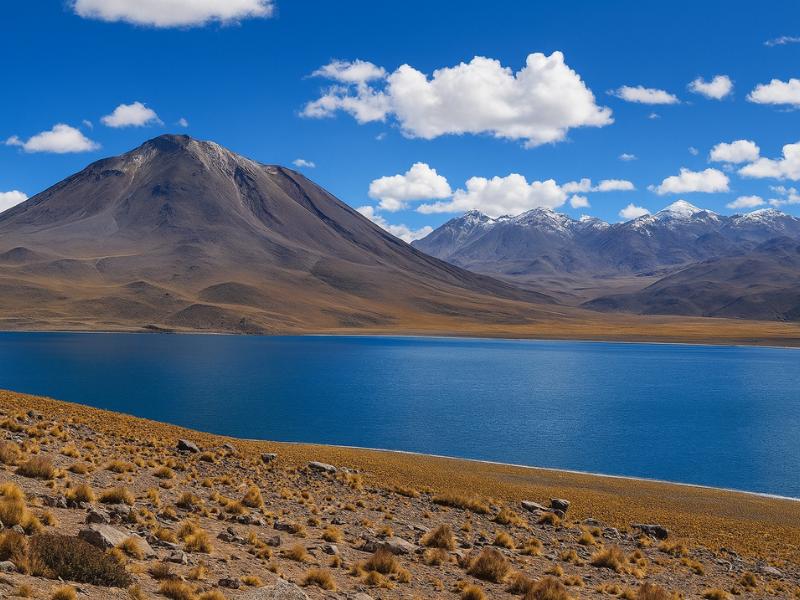
Piedras Rojas And Highland Lagoons
Give a full day to red rocks and highland lagoons without organizing the driving yourself. A connected circuit makes more sense than treating every stop as a separate trip.
A long, high-altitude outing; check participation requirements.
Book on ViatorSee The Piedras Rojas Route ↗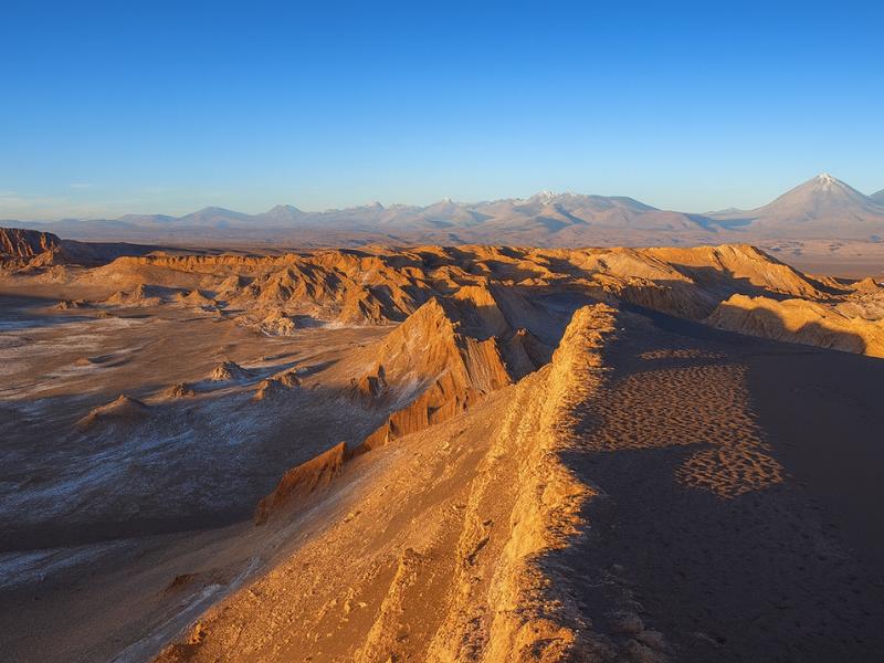
Valley Of The Moon
Make room for a desert landscape outing without committing several days. A guided Moon Valley excursion gives your afternoon a clear destination.
About four hours. Walking is involved; read the participation requirements.
Book on ViatorSee Moon Valley Departures ↗How cold and windy does it get up there?
Expect sub-zero temperatures on the summit in any month, and wind that makes the reading meaningless. The Atacama altiplano is dry and intensely sunny, so the same morning can feel warm in still air and painful in a gust. Windproof outer layers matter more than thick insulation.
The desert around San Pedro can be pleasant at 25°C in the afternoon while the plateau above 5,000 metres sits below freezing at the same moment. Between June and August, which is the southern winter and the driest, clearest window, summit conditions are reliably cold and the wind has real bite. Between January and February the Bolivian winter brings afternoon cloud build-up and occasional snow to the high ground, which is why climbs at that time of year are more often cancelled or cut short.
Two details catch people out. The first is that you sweat on the ascent and then stop moving on the summit, so the twenty minutes on top are the coldest of the day by a wide margin. Carry an extra layer you have not worn yet and put it on before you stop, not after you start shivering. The second is ultraviolet exposure. At 5,600 metres with thin, dry air and reflective ground, sunburn happens fast, including on the underside of the nose and the back of the ears.
| Season | Typical summit conditions | Wind | Practical note |
|---|---|---|---|
| Southern winter, June to August | Well below freezing, very clear skies | Frequently strong, can be biting | The most reliable visibility, the harshest cold |
| Spring, September to November | Below freezing, clear, windy afternoons | Strong and gusty | Good all-round window, dress for wind first |
| Summer, December to February | Around or below freezing, cloud build-up | Variable, storms possible | Highest chance of cancellation or an early turnaround |
| Autumn, March to May | Below freezing, settling clear conditions | Moderate | Quiet season, often excellent |
| Any month, on the summit | Assume sub-zero with wind chill | Assume exposed | Windproof shell, hat, gloves, buff, always |
| Any month, in San Pedro at midday | Warm to hot, very dry | Light | Do not pack based on how the town feels |
Our Atacama packing guide covers the layering system in more detail, and it applies double for this day. Cotton is the wrong choice from the skin out.
What pace should you walk, and how long does each stage take?
Walk slower than feels natural, from the very first step. The rhythm that works at 5,200 metres looks almost comically slow from a distance: short steps, feet placed rather than pushed, a pause of a second at the top of each stride. Guides call it the rest step, and it is the difference between a summit and a retreat.
The classic mistake is starting strong. People step out of a warm vehicle, feel fine for the first hundred metres, walk at their normal pace, and build an oxygen debt they cannot repay at that altitude. Twenty minutes later they are stopped, breathing hard, with a headache starting. The slow, unbroken rhythm feels wrong for the first ten minutes and correct for the next two hours.
Trekking poles, which the tour provides, change the arithmetic more than people expect. On loose ash they stop the backward slide, and on descent they take a large share of the load off the knees. Use them from the bottom rather than deciding halfway up that you want them.
| Stage | Height gained | Slow but steady | Struggling | Sign to reassess |
|---|---|---|---|---|
| First 100 m of gain | 5,200 to 5,300 m | 25 to 35 minutes | 45 minutes or more | Already needing long stops |
| Mid slope | 5,300 to 5,400 m | 25 to 35 minutes | 50 minutes or more | Headache that does not ease when you rest |
| Steep scree band | 5,400 to 5,520 m | 30 to 45 minutes | An hour or more | Nausea, or losing coordination |
| Rim to summit | 5,520 to 5,604 m | 15 to 25 minutes | 40 minutes or more | Confusion, or an unwillingness to speak |
| On the summit | 5,604 m | 20 to 30 minutes | Cut it short | Cold setting in fast |
| Full descent | 5,604 to 5,200 m | 40 to 60 minutes | 75 minutes | Symptoms usually ease within minutes of losing height |
Anything in the struggling column is not a disaster on its own. Combined with symptoms, it is information. A guide watching a client take an hour over a hundred metres of gain while going quiet is reading exactly the signals you would want them to read.
When should you turn back?
Turn back when symptoms get worse as you go higher rather than settling, when a headache does not respond to rest and water, or when balance, speech or judgement change at all. Descending even two hundred metres usually brings fast relief. There is no version of this mountain worth pushing through neurological symptoms for.
Mild acute mountain sickness is common at these heights and is not in itself an emergency: a dull headache, poor appetite, mild nausea, breathlessness at rest that eases when you stop. What guides watch for is the pattern. Symptoms that plateau while you rest are one thing. Symptoms that keep climbing with the ground are another.
The two dangerous conditions, high altitude cerebral oedema and high altitude pulmonary oedema, are rare on a short day trip like this precisely because you do not sleep high and you descend within hours. They are not impossible. The tell-tale signs are loss of coordination, confusion, an unusual persistent cough, or breathlessness that does not settle at all when you stop moving. Those mean immediate descent, not a rest and a try again.
| What you notice | Likely reading | What to do |
|---|---|---|
| Breathing hard, eases within a minute of stopping | Normal at 5,400 m | Keep going slowly |
| Mild headache, eases with water and a rest | Common mild AMS | Continue with caution, tell the guide |
| Headache getting stronger with every hundred metres | Worsening AMS | Stop climbing, descend |
| Nausea, or vomiting | Moderate AMS | Descend |
| Dizziness, stumbling, cannot walk a straight line | Possible cerebral involvement | Immediate descent, do not continue |
| Breathlessness at rest that does not settle, wet cough | Possible pulmonary involvement | Immediate descent, tell the guide at once |
| Confusion, unusual behaviour, not answering questions | Emergency signs | Descend immediately with a companion |
Tell your guide early and honestly. The failure mode we hear about is not people making bad calls, it is people staying quiet because they do not want to slow the group down. Our San Pedro safety guide goes further into altitude illness, medical facilities and what emergency care realistically looks like in a small desert town.
Who should not attempt Cerro Toco?
Anyone with significant heart or lung disease, uncontrolled high blood pressure, sickle cell disease, a recent stroke, advanced pregnancy or a previous episode of severe altitude illness should not go to 5,604 metres on a holiday. Nor should anyone who arrived in San Pedro within the last two days.
This is not a hedge written by lawyers. At 5,600 metres you are in an environment where the air pressure is roughly half of sea level, you are more than two hours from the nearest road-accessible medical care, and there is no helicopter waiting. Any pre-existing condition that limits your oxygen delivery is amplified there. If you take medication for your heart, lungs or blood, ask your own doctor specifically about extreme altitude before you book, not about "hiking in Chile".
Age on its own is not a disqualifier. Fit walkers in their sixties summit this mountain regularly, and unfit twenty-five year olds turn back regularly. What matters is cardiovascular health, acclimatisation and honesty about both. Travellers weighing this up may also want our notes for older visitors to the Atacama, which cover which high tours suit and which do not.
| Situation | Verdict | Better alternative |
|---|---|---|
| Fit, acclimatised four or more days | Good candidate | Go |
| Fit, arrived yesterday | No | Do low tours first, book Toco later in the trip |
| Known heart or lung condition | No, without specific medical clearance | Valle de la Luna, salt lagoons, stargazing |
| Pregnant | No | Low-altitude tours only, ask your doctor about 4,000 m days too |
| Young children | No | See our guide to the Atacama with children |
| Had severe altitude sickness before | No | Stay below 4,000 m and enjoy the desert floor |
| Recovering from a chest infection | No | Postpone, or swap to a lower tour |
| Wants the high views without the climb | Fine | The Piedras Rojas and altiplanic lagoons full day |
What does the tour provide, and what must you bring yourself?
The guided climb includes hotel pickup, transport to the high trailhead, a mountain guide, trekking poles, a helmet and trail snacks. You bring your own layers, gloves, hat, sunglasses, high factor sun cream, water and boots. Nobody will lend you a windproof jacket at 5,400 metres.
The helmet in the inclusions list is a useful signal. It is there because parts of the upper slope are loose, and a group strung out on scree can dislodge stones onto the people below. Wear it when the guide asks rather than treating it as optional kit for a walk-up.
Footwear is where people cut corners and regret it. Trainers on volcanic scree fill with ash within ten minutes and give no ankle support on the descent, which is where most minor injuries on this mountain happen. Boots with a decent sole and mid-height ankle support are the right tool. Gaiters, if you own them, are a small luxury that keeps the grit out.
| Item | Provided on the tour | You bring | Notes |
|---|---|---|---|
| Transport and hotel pickup | Yes | No | Roughly 90 minutes each way |
| Mountain guide | Yes | No | Sets the pace, makes turn-back calls |
| Trekking poles | Yes | Optional own pair | Use from the start, not halfway up |
| Helmet | Yes | No | Loose rock on the upper slope |
| Trail snacks | Yes | Extra sugar if you like | Appetite often disappears up high |
| Windproof shell and warm mid layer | No | Yes, both | The single most important item |
| Hat, gloves, buff or scarf | No | Yes | Extremities suffer first |
| Sunglasses and high factor sun cream | No | Yes | UV at 5,600 m is severe |
| Boots with ankle support | No | Yes | Scree is unkind to trainers |
| Water, at least 1.5 to 2 litres | No | Yes | Dry air dehydrates you faster than you notice |
Choose A Date For Your Outing
Cerro Toco Guided Summit Day
Select your date and party on GetYourGuide for the current price and departure options.
Review The Cerro Toco Climb ↗What can you see from the summit?
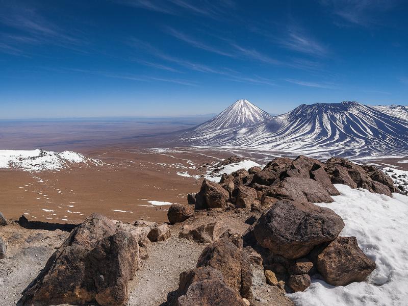
From the crater rim you look across the whole northern altiplano: the perfect cone of Licancabur to the north, Juriques beside it, Láscar smoking gently to the south, the white sheet of the Salar de Atacama far below, and the dish antennas of the Chajnantor astronomy plateau spread out almost beneath your feet.
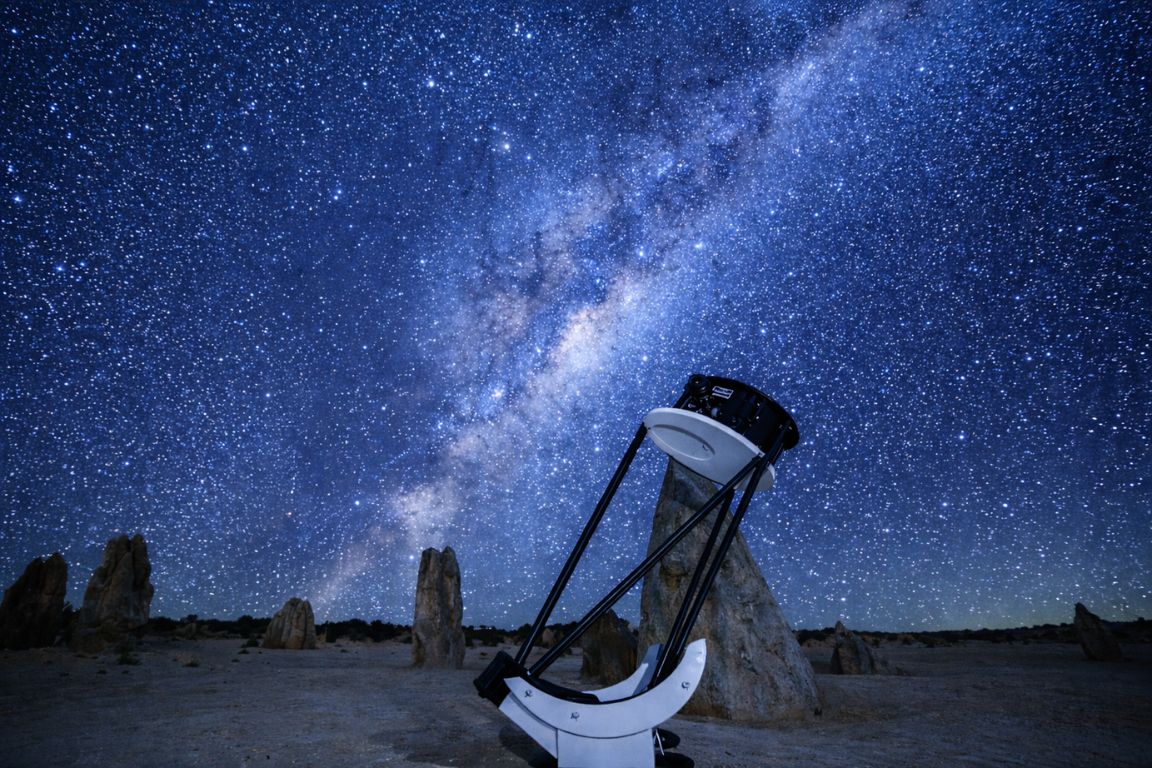
It is the view, rather than the walking, that makes this a genuinely memorable day. Cerro Toco sits at the edge of the Chajnantor plateau, which is where the international radio telescope array operates precisely because the air up there is so dry and stable. The ALMA observatory's own site explains why this particular slab of high desert was chosen over anywhere else on earth. Seeing those antennas from above, tiny and white on an ochre plain, is one of the odder sights in South American travel.
The volcanic skyline is the other half. Licancabur is the one everyone photographs, and from Cerro Toco you see it from an angle almost nobody gets, at nearly eye level rather than craning up from the desert floor. We wrote a whole guide to where to see Licancabur properly, because the mountain is far more photographed than understood.
| What you see | Approximate height | Direction from the summit | Why it matters |
|---|---|---|---|
| Licancabur | About 5,916 m | North | The near-perfect cone above San Pedro |
| Juriques | About 5,700 m | North, beside Licancabur | The blunt, cratered twin |
| Sairecabur | About 5,970 m | North west | Higher than Licancabur, far less famous |
| Láscar | About 5,590 m | South | The region's most active volcano, often steaming |
| Chajnantor plateau and its antennas | About 5,000 m | East and below | One of the driest observatory sites on earth |
| Salar de Atacama | About 2,300 m | South west, far below | The salt flat you visited for the flamingos |
| Bolivian altiplano | Above 4,000 m | North east | The route toward the Uyuni salt flats |
How does the day run from pickup to drop-off?
Pickup is usually mid morning rather than pre-dawn, which is one of the pleasant surprises of this tour. You drive up, walk up, spend twenty or thirty minutes on the summit, descend, and are generally back in San Pedro by mid afternoon. Total elapsed time is about seven hours.
That timing exists for a reason. Wind on the plateau tends to build through the afternoon, so climbs run in the morning window, but there is no need for the brutal 4am start that the El Tatio geysers demand. You get a normal breakfast and a normal night's sleep beforehand, both of which help enormously at altitude.
| Approximate time | What happens | Altitude |
|---|---|---|
| Mid morning | Hotel pickup in San Pedro | About 2,400 m |
| Plus 60 to 75 minutes | Highway climb toward Paso Jama | Up to about 4,600 m |
| Plus 20 minutes | Plateau road, brief stops for photos | Around 4,800 to 5,100 m |
| Arrival at trailhead | Kit check, poles and helmets issued, briefing | Roughly 5,100 to 5,200 m |
| Next 1.5 to 2.5 hours | Ascent at guided pace | Up to 5,604 m |
| Summit | Photos, layers on, short stay | 5,604 m |
| Following hour | Descent on scree | Down to about 5,200 m |
| Final 90 minutes | Drive back, usually quiet | Down to 2,400 m |
Plan nothing demanding for the evening. Most people are more tired than they expect, and a heavy meal or a few drinks that night will make the following morning worse than the climb did.
What pairs well with a Cerro Toco day?
Pair Cerro Toco with a genuinely easy day either side. The high lagoons circuit is a good build-up because it puts you above 4,000 metres without asking you to walk uphill, and the canyoning and trekking adventure suits people who want a second hard day but at kinder altitude.
For a build-up, the Piedras Rojas, altiplanic lagoons and Chaxa full day is the tour we would put two or three days before a summit attempt. It is listed at $110, runs about ten hours, and rides above 4,000 metres for a large part of the afternoon with very little walking. That combination is close to ideal: real altitude exposure, minimal exertion, and a clear read on how your body responds.
For travellers who want more physical challenge without going higher, the canyoning and trekking adventure, listed at $189 over about six hours, delivers rappels down waterfalls and a high desert hike. It sits well after the climb, not before, since it will leave you tired.
| Tour | Listed price | Duration | Approximate maximum altitude | Best used |
|---|---|---|---|---|
| Cerro Toco volcano climb | $150 | About 7 hours | 5,604 m | Late in the trip, after high-altitude days |
| Piedras Rojas, altiplanic lagoons and Chaxa | $110 | About 10 hours | Above 4,000 m | Two or three days before the climb |
| Canyoning and trekking adventure | $189 | About 6 hours | Around 3,000 m | After the climb, if you still have energy |
| El Tatio geysers | $62 | About 8 hours | About 4,300 m | Mid trip, never the morning after arrival |
| Valley of the Moon | $35 | About 4 hours | About 2,600 m | Day one or two, no altitude load |
If you are still deciding how long to stay, our guide to how many days the Atacama needs lays out why a summit attempt effectively adds two days to a trip: one for the climb, one for the acclimatisation day it deserves beforehand.
Is Cerro Toco worth it compared with the other volcano options?
Cerro Toco is the only high summit here that a fit, acclimatised traveller can realistically reach on a guided day trip. Licancabur is a serious expedition normally staged from Bolivia, and Láscar is an active volcano with access that opens and closes with its behaviour. Toco is the practical choice, not a consolation prize.
People arrive in San Pedro wanting to climb Licancabur because it is the cone they can see from the plaza. Almost none of them do, and the reasons are covered honestly in our Licancabur guide. Láscar attracts the same curiosity and has a different obstacle, described in the Láscar volcano guide: it is the most historically active peak in the northern Chilean Andes, and access reflects that.
| Peak | Approximate height | Sold as a climb here | Reality for visitors |
|---|---|---|---|
| Cerro Toco | 5,604 m | Yes | Guided day trip, high trailhead, walk-up terrain |
| Licancabur | About 5,916 m | No | Serious ascent, normally arranged from the Bolivian side |
| Láscar | About 5,592 m | No | Active volcano, access varies with monitored activity |
| Sairecabur | About 5,970 m | No | Occasionally climbed, not a mainstream tourist objective |
| Chajnantor plateau | About 5,000 m | Passed on the way | Seen from the Cerro Toco road, not a hiking destination |
Stand on Toco's rim and you have the whole thing in one frame anyway: Licancabur to one side, Láscar to the other, and a plateau of radio telescopes below. For most travellers that is a better outcome than a week of expedition logistics.
Make It Part Of Your Trip
Review this guided Cerro Toco outing and contact the provider before booking, as their listing requests.
Cerro Toco Guided Summit Day
A mountain guide and transport from San Pedro for a demanding summit outing. This is a hiking day, distinct from a viewpoint stop on a sightseeing circuit.
Review The Cerro Toco Climb ↗