Lascar Volcano: The Active Peak You See, Not Summit
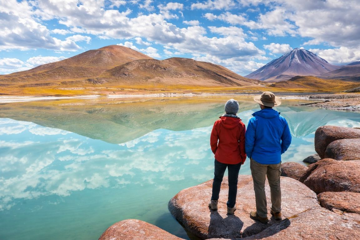
Somewhere on the drive between Socaire and the red rocks of Piedras Rojas, a guide will point south east at a long, dark, unglamorous mountain with a wisp of steam at its top. That is Lascar, and it is the peak in this desert most likely to do something.
Can you climb Lascar volcano from San Pedro de Atacama?
Not on a standard tour, and we do not sell a Lascar climb. Access to the mountain is periodically restricted depending on its monitored activity level, and it is an active volcano with a documented history of explosive eruptions. Visitors who want a high summit here climb Cerro Toco instead.
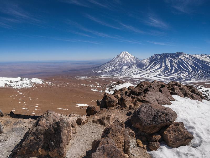
The distinction matters and it is not the same as the Licancabur situation. Licancabur is off the table for border and route reasons. Lascar is off the table because it is genuinely restless. Chile's geological survey monitors it continuously, and the alert level attached to it can change, taking the surrounding access with it.
Ascents of Lascar have happened, generally from the Talabre side, with permission and in periods of quiet. They are not something you book from a shopfront on Caracoles street the way you book the geysers. Treat any offer of a casual Lascar summit with real suspicion, and check the current status through Chile's national geology and mining service, which publishes volcano monitoring information.
| Lascar key facts | Detail |
|---|---|
| Summit altitude | About 5,592 m |
| Location | East of the Salar de Atacama, near the village of Talabre |
| Type | Stratovolcano with a line of overlapping craters |
| Activity status | The most historically active volcano in the northern Chilean Andes |
| Largest recent eruption | April 1993, a major explosive event |
| Monitoring | Continuous, by Chile's national geological service |
| Climb sold by this site | No |
| Where you see it | The highland lagoons and Piedras Rojas circuits, and from Cerro Toco |
None of that makes Lascar a disappointment. It is one of the most interesting things you will look at from a tour vehicle in this region, precisely because it is alive in a way the other cones on the skyline are not.
Choose A Landscape Day, Not An Assumed Ascent
Choose what you want and the time you can give it. The result explains the trade-off before you open the booking page.
How high is Lascar and where exactly is it?
Lascar rises to about 5,592 metres on the eastern edge of the Salar de Atacama basin, roughly south east of San Pedro de Atacama and close to the small Andean village of Talabre. It is not visible from San Pedro itself, which is why many visitors never realise it is there until a guide points it out.
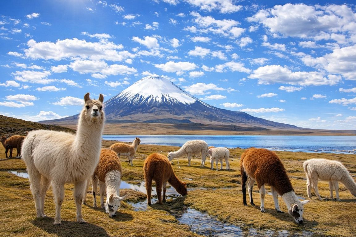
Geography explains the confusion. Licancabur stands north east of town and dominates every photograph. Lascar sits further south and is screened by intervening ridges, so from the plaza you simply do not see it. Drive south along the edge of the salt flat toward Toconao and Socaire, and it comes into view as a long dark ridge rather than a classic cone.
That shape is a clue to its behaviour. Rather than one neat summit, Lascar has a row of overlapping craters aligned roughly north east to south west, the product of repeated activity shifting along the same weak line in the crust. The currently active crater usually shows a persistent steam plume in clear conditions, faint in the morning and often more visible in cold air.
| Feature | Lascar | Licancabur | Cerro Toco |
|---|---|---|---|
| Height | About 5,592 m | About 5,916 m | 5,604 m |
| Direction from San Pedro | South east | North east | East, behind the highway ridge |
| Visible from town | No | Yes, dominant | Not prominently |
| Shape | Elongated, multiple craters | Near-perfect cone | Rounded cone on a high plateau |
| Active | Yes, persistently | No historical eruptions recorded | No |
| Climb available here | No | No | Yes, guided day climb |
| Best seen from | Socaire to Piedras Rojas road | San Pedro, Valle de la Luna, the air | Its own summit is the attraction |
Why is Lascar the most active volcano in northern Chile?
Lascar sits on the volcanic arc formed where the Nazca plate slides beneath South America, and it has erupted repeatedly in recorded history. Its largest recent event, in April 1993, sent an ash column high into the atmosphere, with fall reported at enormous distances downwind.
The mechanism is the same one that built every peak on this skyline. Ocean floor descends beneath the continent, water is driven off the sinking plate, the overlying mantle melts, and magma works its way upward. What separates Lascar from its neighbours is that its plumbing has stayed open and productive while theirs has largely gone quiet.
The 1993 eruption is the reference point locals use. It was a genuinely large explosive event, the ash column rose many kilometres, and the plume drifted across the Andes far to the south east. Smaller ash emissions and explosions have been recorded on various occasions since, most of them brief and localised, some of them enough to close access to the immediate area for a period.
Day to day, what visitors see is undramatic: a thin steam plume, sometimes a faint sulphur smell if the wind is wrong at a nearby viewpoint, and a summit area streaked yellow with sulphur deposits. That is the ordinary state of a volcano that is simply breathing.
| Period | What is documented | Effect on visitors today |
|---|---|---|
| Pre-1990s | Repeated recorded eruptions through the twentieth century | Established Lascar's reputation as the region's restless peak |
| April 1993 | The largest explosive eruption in recent history, tall ash column | Ashfall reported far downwind, the event locals still reference |
| Since 1993 | Intermittent smaller ash emissions and explosions | Occasional short-term access restrictions nearby |
| Ordinary conditions | Persistent degassing, visible steam plume | Photogenic from the highland circuit, no impact on tours |
| Current status | Continuously monitored with a published alert level | Check before planning anything near the mountain itself |
Is it safe to travel near Lascar on a tour?
Yes, for the standard highland circuits. Those routes pass at a distance along public roads between Socaire and the Piedras Rojas area, well outside any hazard zone, and operators follow official guidance if the alert level changes. What varies is access to the mountain's immediate flanks, not the tourist circuit.
It helps to separate two very different things. Driving the altiplano road with Lascar on the horizon is routine and carries no meaningful volcanic risk. Approaching the crater rim is a different activity entirely, subject to permission and the current alert level, and it is not something the tours in our catalogue do.
Chile's monitoring system publishes a colour-coded alert for each active volcano, and the regional authorities restrict access accordingly. When the level rises, tours simply run their usual route and you look at the mountain from further away, which is what you were going to do anyway.
The realistic risks on a highland circuit day have nothing to do with lava. They are altitude, cold, sun and the long hours in a vehicle. Those are covered properly in our San Pedro safety guide and, for the altitude side specifically, in the altitude and tour order guide.
| Activity | Volcanic risk | Real risk on the day | Available here |
|---|---|---|---|
| Highland circuit drive past Lascar | Negligible at circuit distance | Altitude above 4,000 m, cold, sun | Yes |
| Stops at Miscanti and Miniques lagoons | Negligible | Altitude, wind chill | Yes |
| Piedras Rojas viewpoint | Negligible | Altitude, thin air on short walks | Yes |
| Approaching Lascar's flanks | Depends entirely on alert level | Access restrictions, exposure | No |
| Crater rim ascent | Real, activity dependent | Gas, terrain, extreme altitude | No |
The Direct Fit And Useful Alternatives
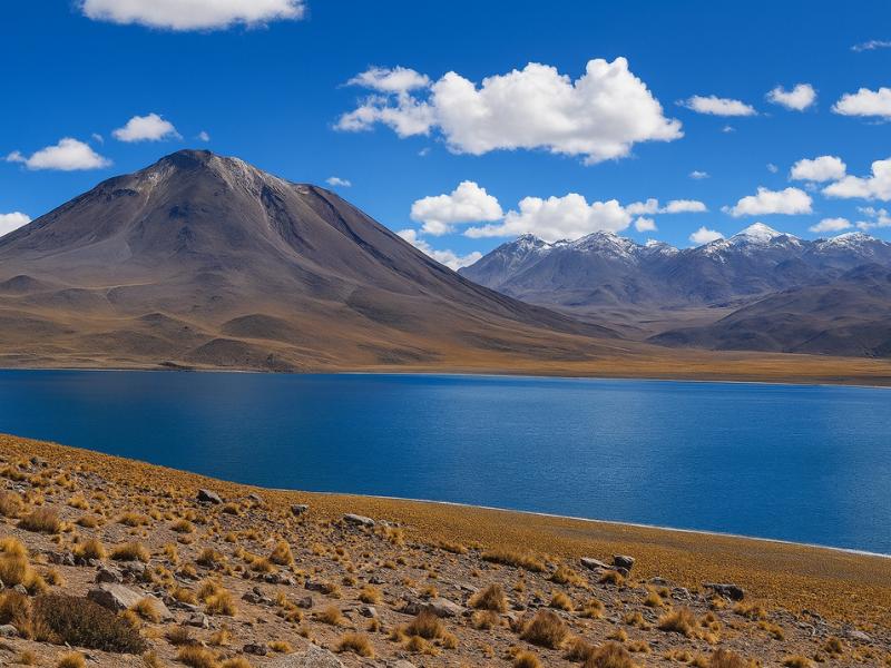
Piedras Rojas And Highland Lagoons
Give a full day to red rocks and highland lagoons without organizing the driving yourself. A connected circuit makes more sense than treating every stop as a separate trip.
A long, high-altitude outing; check participation requirements.
Book on ViatorSee The Piedras Rojas Route ↗Cerro Toco Guided Summit Day
A mountain guide and transport from San Pedro for a demanding summit outing. This is a hiking day, distinct from a viewpoint stop on a sightseeing circuit.
Provider asks you to contact them before booking. Acclimatization and suitability need discussing; no summit guarantee.
Book on GetYourGuideReview The Cerro Toco Climb ↗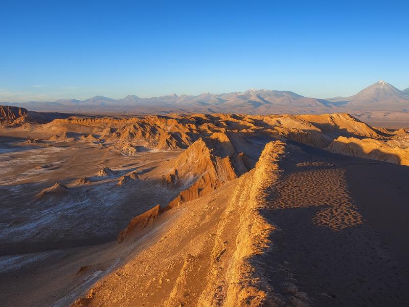
Valley Of The Moon
Make room for a desert landscape outing without committing several days. A guided Moon Valley excursion gives your afternoon a clear destination.
About four hours. Walking is involved; read the participation requirements.
Book on ViatorSee Moon Valley Departures ↗Where do you actually see Lascar from?
The best views are from the road between Socaire and Piedras Rojas, from the Miscanti and Miniques lagoon viewpoints, and from the summit of Cerro Toco looking south. On a clear morning the steam plume is visible from all three, and the mountain reads as a long dark ridge rather than a cone.
The full-day highland circuits are the practical answer for almost everyone. They climb from the salt flat through Toconao and Socaire onto the altiplano, and as they gain height Lascar swings into view on the eastern side. Guides usually stop for it, though it is rarely a headline stop the way the red rocks or the lagoons are.
Timing helps. Early to mid morning gives the clearest air, and cold air makes the steam plume stand out more sharply against the sky. By mid afternoon in summer the whole horizon can be hazy and the mountain flattens into a grey smudge.
| Viewpoint | Approximate altitude | What you see | Tour that goes there |
|---|---|---|---|
| Socaire to Piedras Rojas road | 3,500 to 4,300 m | The full ridge line, plume in clear air | Piedras Rojas full-day circuit |
| Miscanti and Miniques viewpoints | Above 4,000 m | Lascar beyond the lagoon basins | All highland circuit tours |
| Salar de Aguas Calientes area | Around 4,200 m | Distant ridge across pale salt ground | Piedras Rojas circuits |
| Cerro Toco summit | 5,604 m | Looking down the volcanic chain to the south | Cerro Toco climb |
| Road south from Toconao | About 2,500 m | First glimpses over the salt flat edge | Any circuit heading south |
| San Pedro de Atacama | About 2,400 m | Nothing, it is screened by ridges | Not visible |
If you want the lagoons and the volcano in one frame, the Miscanti and Miniques guide covers where the stops sit and how long you get at each.
Lascar or Cerro Toco: which summit works for visitors?
Cerro Toco, without much argument. It is 5,604 metres against Lascar's 5,592, so you barely lose any height, and it is reachable as a guided day climb from a trailhead above 5,100 metres. Lascar is an active volcano with variable access. One is a holiday. The other is a project.
Travellers who arrive wanting to climb something high tend to fixate on whichever volcano they heard about first. The useful reframing is that the two mountains are almost the same height. Standing on Cerro Toco puts you within a dozen metres of Lascar's altitude, with a view that includes Lascar itself, Licancabur to the north and the Chajnantor astronomy plateau below.
The guided Cerro Toco climb is listed at $150 for about seven hours, rated 5 across 471 or more bookings, with trekking poles, helmet and trail snacks included. The walk is roughly 400 vertical metres of loose scree, short in distance and severe in altitude. Full detail lives in our Cerro Toco climb guide.
| Comparison | Cerro Toco | Lascar |
|---|---|---|
| Summit height | 5,604 m | About 5,592 m |
| Sold as a guided day climb | Yes, listed at $150 | No |
| Vertical gain on foot | About 400 m from a high trailhead | Substantially more, from a lower start |
| Access reliability | Stable, weather dependent only | Varies with monitored volcanic activity |
| Volcanic hazard | None, the volcano is not active | Real, gas and eruption risk near the crater |
| Typical day length | About 7 hours door to door | A full expedition day with permissions |
| View includes the other peak | Yes, Lascar visible to the south | Yes, but few visitors get there |
| Recommendation | The practical summit for visitors | Photograph it from the circuit |
What does the highland circuit day actually look like?
You leave San Pedro early, drive south along the Salar de Atacama, stop at Toconao and Socaire, climb onto the altiplano for the Miscanti and Miniques lagoons and Piedras Rojas, and drop back down to Chaxa for the flamingos. Ten to twelve hours, most of it above 3,500 metres, with Lascar in view for a good part of it.
Two versions of this day exist in our catalogue and they differ in length and group size rather than in the essential route. The Piedras Rojas, altiplanic lagoons and Chaxa full-day experience is listed at $110 across about ten hours, rated 4.9 from 3,929 or more bookings, and includes hotel pickup, breakfast, the villages and the Tropic of Capricorn stop. The Red Stones, Altiplanicas and Chaxa experience runs longer at about twelve hours, listed at $120, rated 4.9 from 1,346 or more bookings, with breakfast and lunch and a bilingual guide.
Both are long days that start in the dark and involve a lot of sitting, punctuated by short walks at altitudes where short walks feel long. That is worth knowing in advance. It is not a hiking day, and the physical demand is low, but the altitude exposure is sustained for hours.
| Stop | Approximate altitude | Typical time there | Lascar visible |
|---|---|---|---|
| San Pedro de Atacama, departure | About 2,400 m | Pickup | No |
| Toconao village | About 2,500 m | 20 to 40 minutes | Occasionally, over the basin edge |
| Tropic of Capricorn marker | About 2,500 m | 10 minutes | Distantly |
| Socaire village | About 3,500 m | 20 to 40 minutes, often lunch | Yes, on clear days |
| Miscanti and Miniques lagoons | Above 4,000 m | 40 to 60 minutes | Yes |
| Piedras Rojas and Salar de Aguas Calientes | Around 4,200 m | 40 to 60 minutes | Yes, across pale ground |
| Laguna Chaxa | About 2,300 m | 40 to 60 minutes | No, too low and too close in |
| Return to San Pedro | About 2,400 m | Evening | No |
How much altitude does the Lascar circuit put you through?
You spend several consecutive hours above 3,500 metres and a stretch above 4,000, with the highest road sections near 4,300 to 4,500 metres. That is enough to give a headache to anyone who arrived in San Pedro two days ago, and it is the reason this tour belongs in the middle of a trip rather than at the start.
The pattern of the day matters as much as the peak figure. You climb gradually through the morning, sit high through the middle of the day, then descend for the afternoon. Gradual ascent by vehicle is much kinder than the rocket climb to El Tatio, which takes you from 2,400 to 4,300 metres in the dark in about two hours.
Practical measures work. Drink water steadily from the moment you get in the vehicle, eat the breakfast even if you do not feel like it, skip alcohol the night before, and move slowly at the lagoon stops. Walking briskly uphill to a viewpoint at 4,200 metres is how a fine day turns into a headache that lasts until evening.
| Time of day | Approximate altitude | Cumulative time above 3,500 m | What to do |
|---|---|---|---|
| Early morning | 2,400 to 2,500 m | None | Drink water, eat something |
| Mid morning | 2,500 to 3,500 m | Starting | Keep drinking, no rushing at stops |
| Late morning | 3,500 to 4,200 m | 1 to 2 hours | Walk slowly, add a layer |
| Midday | 4,000 to 4,500 m | 2 to 4 hours | Peak exposure, this is where symptoms show |
| Early afternoon | 4,200 to 3,500 m | 4 to 5 hours | Symptoms usually ease on the descent |
| Late afternoon | 2,300 to 2,400 m | Finished | Rest, hydrate, light dinner |
Choose A Date For Your Outing
Piedras Rojas And Highland Lagoons
Select your date and party on Viator for the current price and departure options.
See The Piedras Rojas Route ↗What should you pack for a Lascar circuit day?
Layers you can shed and re-add all day, sunglasses, high factor sun cream, a hat that stays on in wind, and more water than you think. The day starts near freezing, hits strong sun by mid morning at 4,000 metres, and gets cold again at the exposed lagoon viewpoints.
The temperature swing is the thing people underestimate. A pickup at 6am in San Pedro in winter can be several degrees below zero. By noon at Piedras Rojas the sun is fierce even though the air is cold, so you can burn badly while feeling chilly. That combination catches almost every first-time visitor.
Bring cash in small notes for village purchases and any local entry contributions, since card acceptance in Toconao and Socaire is limited. Bring snacks even on tours that include meals, because appetites are unpredictable at altitude and a long gap between stops is common. Our full Atacama packing guide has the detailed list.
| Item | Why | Priority |
|---|---|---|
| Windproof outer layer | Exposed lagoon viewpoints above 4,000 m | Essential |
| Warm mid layer, fleece or down | Sub-zero mornings, cold high stops | Essential |
| Sunglasses with real UV protection | Extreme UV, reflective salt ground | Essential |
| High factor sun cream and lip balm | Burns happen fast at 4,000 m | Essential |
| 1.5 to 2 litres of water | Dry air, long day, altitude | Essential |
| Hat with a chin cord or a beanie | Wind takes loose hats immediately | Strongly advised |
| Small cash in local notes | Village purchases, limited card use | Strongly advised |
| Snacks with sugar | Appetite drops at altitude | Useful |
| Camera with a moderate telephoto | Lascar is distant, wide lenses shrink it | Optional |
Who should think twice about the highland circuit?
Anyone who arrived in San Pedro within the last twenty-four hours, anyone with a heart or lung condition who has not spoken to a doctor about 4,000 metres, and anyone who struggled badly on a previous high-altitude trip. The circuit is physically easy and altitudinally demanding, which is an unusual combination.
The low physical demand fools people. Because you sit in a vehicle for most of it, the tour reads as gentle, and travellers who would never book a hiking day book this one. Then they spend four hours above 3,500 metres and feel worse than they have all trip. Sitting still at altitude is still altitude.
Children handle it variably and cannot always describe what they feel, which is the difficulty. Older travellers in good health generally do fine, particularly if the circuit falls late rather than early in the trip. There is more on both in our guide to the Atacama with children and our notes for older visitors.
| Traveller | Verdict on the highland circuit | Alternative |
|---|---|---|
| Acclimatised three or more days | Go, it is one of the best days here | None needed |
| Arrived yesterday | Postpone by two or three days | Valle de la Luna or the salt lagoons |
| Heart or lung condition | Ask a doctor about sustained 4,000 m exposure first | Low-altitude tours around town |
| Pregnant | Seek medical advice before booking | Low-altitude tours |
| Young children | Long day, hard for them to report symptoms | Shorter, lower half-day tours |
| Bad experience at altitude before | Consider skipping the high section | Chaxa and the villages only, if an operator allows |
| Motion sensitive | Manageable, but the road is winding | Sit forward, take remedies early |
How does Lascar shape a wider Atacama itinerary?
Use the volcano as a marker for your high-altitude day rather than a destination. Put the highland circuit in the middle of your trip, after two low days and before any summit attempt, and the mountain becomes both a highlight and useful preparation for higher ground.
A clean four to five day sequence looks like this. Arrive and rest. Do Valle de la Luna or the salt lagoons on day two at around 2,500 metres. Take the highland circuit on day three or four, which lifts you above 4,000 metres for hours and gives you the Lascar views. If you want a summit, put Cerro Toco on day five or six, by which point your body has real data behind it.
The lagoons the circuit visits sit within Los Flamencos National Reserve, managed by Chile's national forestry corporation, which is also why entry fees appear as line items on most tour inclusions. Our Piedras Rojas guide and the El Tatio geysers guide cover the other two big altitude days in the region.
| Day | Tour | Approximate maximum altitude | Why here in the order |
|---|---|---|---|
| 1 | Arrive, walk the village | About 2,400 m | First night is always the worst sleep |
| 2 | Valle de la Luna or Baltinache lagoons | About 2,300 to 2,600 m | Full day out with no altitude load |
| 3 | Highland circuit with Piedras Rojas and the lagoons | Above 4,000 m | The Lascar views, and real altitude practice |
| 4 | El Tatio geysers, or a rest day | About 4,300 m | Second high day, or recovery |
| 5 | Cerro Toco climb | 5,604 m | Only worth attempting once acclimatised |
Read that alongside the full altitude and tour order guide, which sets out the same logic for three, four and five day trips with every tour placed on an altitude ladder.
Is Lascar worth caring about if you cannot climb it?
Yes, because it is the one mountain here that is visibly doing something. Licancabur is a beautiful dormant shape. Lascar has a plume, a sulphur-streaked crater and a documented eruption history, which makes the drive past it the most geologically alive twenty minutes of your circuit day.
There is also a human story attached, and guides tell it well. Communities living at the foot of an active volcano have adapted around it, and the small village of Talabre, closest to the mountain, has moved within living memory. Farming continues on terraces that depend on meltwater from the same high ground that produces the hazard. That tension between resource and risk is the real subject of the Andes.
The most interesting mountain on a skyline is not always the one you can stand on top of.
Practically, then, treat Lascar as a viewing objective and Cerro Toco as a climbing objective. Book the Piedras Rojas and altiplanic lagoons full day or the longer Red Stones, Altiplanicas and Chaxa experience for the views, and add the Cerro Toco climb if a high summit is what you came for.
Make It Part Of Your Trip
Choose the named red-rock and lagoon circuit. This booking is not a Lascar climb or a guaranteed volcano-viewing stop.
Piedras Rojas And Highland Lagoons
Give a full day to red rocks and highland lagoons without organizing the driving yourself. A connected circuit makes more sense than treating every stop as a separate trip.
See The Piedras Rojas Route ↗