Piedras Rojas: The Red Rocks of Salar de Talar
The rust-coloured shoreline at Salar de Talar sits just above 4,000 metres, roughly 150 kilometres south of San Pedro de Atacama. Almost everyone reaches it on a 10 to 12 hour circuit, and the altitude decides how the whole day feels.
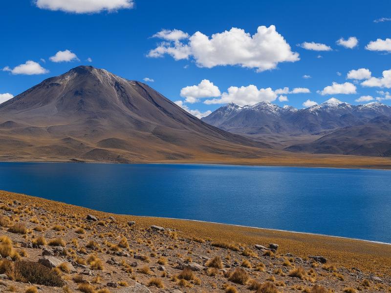
What is Piedras Rojas, and where exactly is it?
Piedras Rojas is a stretch of rust-coloured volcanic rock along the shore of Salar de Talar, in the Antofagasta Region of northern Chile. It sits a little above 4,000 metres, roughly 150 kilometres by road south of San Pedro de Atacama, reached by the highway that climbs past Toconao and Socaire.
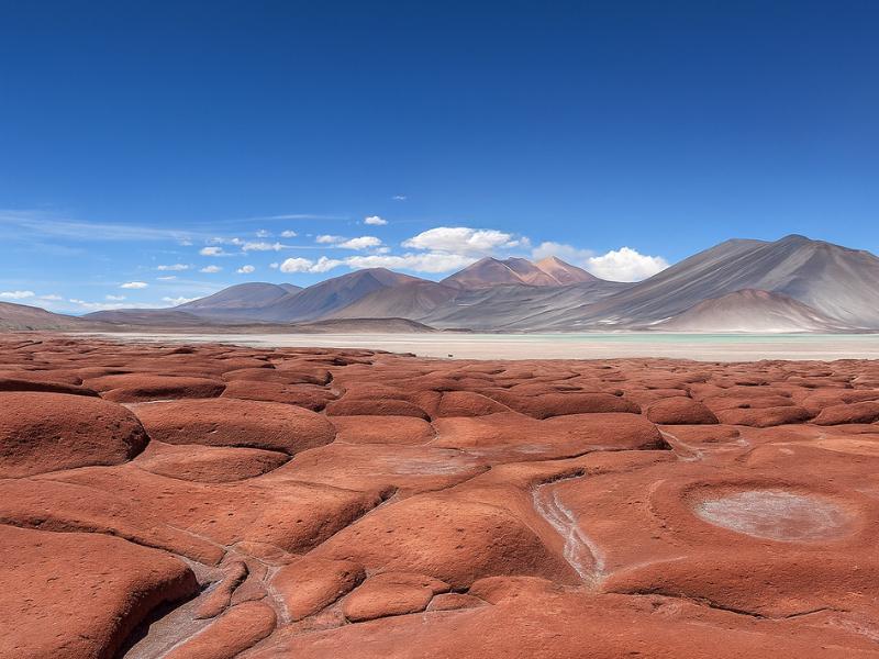
The name is a tour-industry label rather than a place on the map. Ask for Salar de Talar and any local driver will know it. Ask for Piedras Rojas and they will know it too, because that is what every operator has printed on the side of their van for the past decade.
What you are looking at is a shallow high-altitude salt basin. The floor is white crust. The water sitting on it runs from pale milk to a hard turquoise depending on depth, mineral load and how much light is hitting it. Around the edge, broken volcanic rock has oxidised to a deep brick red. Behind that, the peaks of the Cordón de Puntas Negras rise in a line, and on a clear day the whole thing reads as three flat bands of colour stacked on top of each other.
The site is small. You are not walking across a landscape for hours. You stand on a low rise above one specific bay of the salar, where the red rock, the white crust and the coloured water all meet in a single frame. That concentration is exactly why it photographs so well and why it has become the most requested stop on the southern circuit.
Geographically this belongs to the Puna de Atacama, the high plateau that runs east into Argentina and north into Bolivia. It is a different world from the oasis floor at San Pedro. The Atacama Desert as a whole is defined by its dryness, but up here the defining features are altitude, wind and cold.
Make The Red Rocks Part Of A Full Day
Choose what you want and the time you can give it. The result explains the trade-off before you open the booking page.
Why are the rocks red?
Iron in the volcanic rock has oxidised. The surrounding peaks are built from iron-bearing lava, and centuries of exposure to thin dry air, strong ultraviolet light and mineral-rich brine have rusted the exposed surfaces. The result is a coating of iron oxide, the same chemistry that turns iron red, spread across an entire shoreline.
Two things make the effect look stronger than it should. The first is contrast. Set a rust-red rock against a bone-white salt crust and a turquoise pool and the eye reads all three colours as more saturated than they are. Take the same rock and photograph it against brown desert and it looks ordinary.
The second is moisture. Wet rock is darker and redder than dry rock. After rain, or where brine has splashed and dried, the red deepens noticeably. In the driest weeks of the year the same stones look dustier and more orange. Neither is a trick, but it explains why two visitors on different days come home with photographs that do not look like the same place.
Nothing about the colour is seasonal in the way autumn leaves are. The rock is the rock. What changes is the water level in the salar, the angle of the sun and how recently it has rained on the plateau.
How high is Piedras Rojas, and how does the altitude feel?
Salar de Talar sits just above 4,000 metres, and the road reaching it climbs higher still. San Pedro de Atacama is about 2,400 metres, so a single morning gains close to 2,000 metres of elevation. Most people notice it as breathlessness on the short walk, a dull headache, and less patience than usual.
Altitude is the spine of this destination, and this particular day trip is the sharpest example of it. You wake at the oasis, you eat breakfast at village level, and by late morning you are standing where the air holds roughly 60 per cent of the oxygen it does at sea level. The climb happens inside a vehicle, which means your body gets very little warning.
| Stop on the circuit | Approximate altitude | Roughly when you reach it | What people usually feel |
|---|---|---|---|
| San Pedro de Atacama (pickup) | 2,400 m | Early morning | Baseline, most visitors already partly adjusted |
| Toconao village | 2,500 m | First 45 minutes | No noticeable change |
| Laguna Chaxa, Salar de Atacama | Around 2,300 m | Morning or late afternoon | The lowest point of the whole day |
| Socaire village | Around 3,500 m | Mid-morning | First real gain, some shortness of breath on stairs |
| Lagunas Miscanti and Miñiques | Around 4,100 m | Late morning | Slow walking, cold, headaches begin for some |
| Highest point on the road | Above 4,300 m | Between the lagoons and Talar | Brief exposure, usually inside the vehicle |
| Piedras Rojas, Salar de Talar | Just above 4,000 m | Around midday | The longest sustained time you spend high |
The pattern that catches people out is the return. You feel fine on the way up because adrenaline and scenery carry you, then the headache arrives in the van on the descent, when there is nothing to look at and you have stopped drinking water. Operators see this every day. Drink more than feels necessary from the moment you leave San Pedro, eat something at every stop even if you have no appetite, and walk slowly at the salar rather than rushing the viewpoint.
Anyone who landed in Calama within the last 24 hours should think hard before booking this as a first activity. Our sequencing notes in the Atacama altitude and tour order guide set out a safer running order, and the short version is simple: give the desert two nights before you go above 4,000 metres.
How long is the drive, and what does the full day look like?
Plan on 2.5 to 3 hours of driving each way, and a total day of 10 to 12 hours door to door. Pickups run early, usually between 07:00 and 08:00. The circuit is a long loop rather than an out-and-back, so the villages, lagoons and salt flat are all threaded onto the same road.
The shape below is typical rather than promised. Every operator sequences it slightly differently, and some run Chaxa first thing while others save it for the light at the end of the afternoon.
| Approximate time | Where you are | How long you stop | What happens |
|---|---|---|---|
| 07:00 to 08:00 | Hotel pickup in San Pedro | Rolling | Van collects across town, then heads south |
| 08:00 to 09:00 | Toconao | 30 to 45 min | Breakfast, bell tower, craft stalls, last reliable toilets for a while |
| 09:30 to 10:30 | Socaire | 20 to 45 min | Terraces, church, coffee stop as the climb begins |
| 11:00 to 12:00 | Miscanti and Miñiques | 45 to 60 min | Short shoreline walk at around 4,100 m |
| 12:30 to 13:30 | Piedras Rojas, Salar de Talar | 40 to 60 min | Viewpoint walk, photographs, the furthest point of the day |
| 14:00 to 15:00 | Lunch stop | 45 to 60 min | Usually back down at Socaire or a roadside spot |
| 16:00 to 17:30 | Laguna Chaxa | 45 to 60 min | Flamingos on the salt flat, low sun |
| 18:00 to 19:30 | Back in San Pedro | - | Dropped at your hotel, occasionally later in summer |
That is a long time in a vehicle. Roughly five to six hours of the day is driving. People who hate sitting still should know that in advance, and people who get car sick should take something before the pickup rather than after the first bend, because the road above Socaire has plenty of them.
The Direct Fit And Useful Alternatives
Piedras Rojas And Highland Lagoons
Give a full day to red rocks and highland lagoons without organizing the driving yourself. A connected circuit makes more sense than treating every stop as a separate trip.
A long, high-altitude outing; check participation requirements.
Book on ViatorSee The Piedras Rojas Route ↗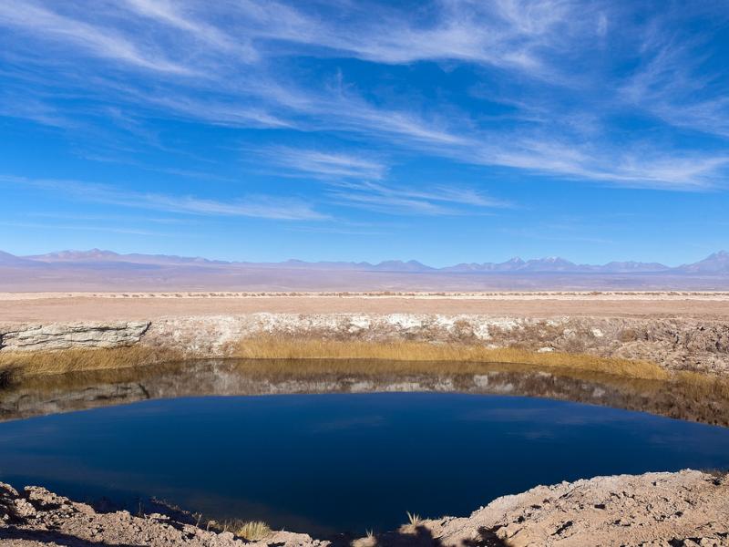
Laguna Cejar And Nearby Lagoons
Choose a lagoon outing for a change of pace from rocky valleys. This route combines Cejar with nearby Ojos del Salar and Tebenquiche.
About five hours. Bring sun protection; the itinerary and bathing access depend on current conditions.
Book on ViatorBook A Cejar Lagoon Outing ↗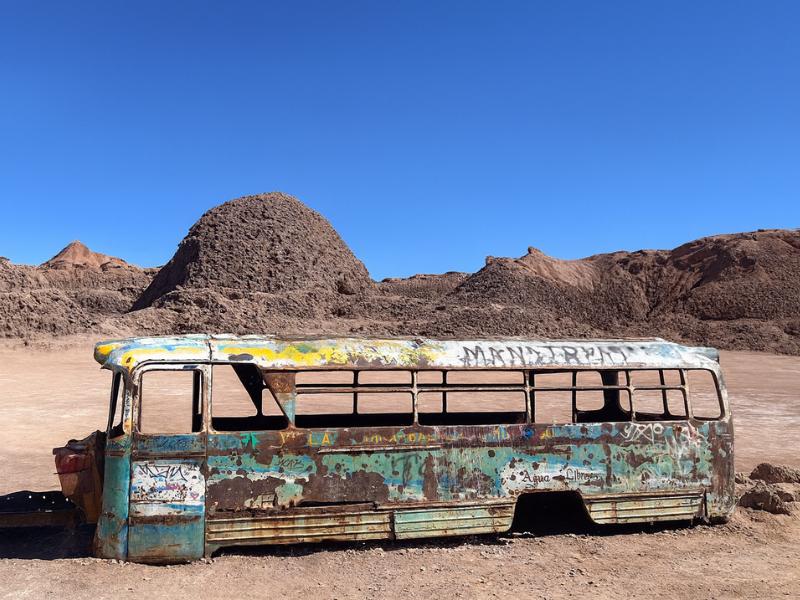
Vallecito And Magic Bus
Give your camera a different desert subject: Vallecito and the Magic Bus. The outing includes snacks, with pickup offered within the operator’s coverage.
Meeting point available outside the pickup area.
Book on ViatorSee The Magic Bus Outing ↗Why is Piedras Rojas never sold as a standalone trip?
The economics and the geography both rule it out. Salar de Talar is around three hours away on a route that passes Toconao, Socaire, the altiplanic lagoons and the edge of the Salar de Atacama. Driving six hours to look at one viewpoint for 40 minutes, then driving past everything else without stopping, would cost the same and deliver far less.
Every operator on this route runs the same logic. Fuel, a guide, park and community fees, and a vehicle capable of the altitude are fixed costs whether you stop once or five times. Adding the stops costs almost nothing and transforms the day. That is why the product you will find on every shelf in San Pedro is a combined circuit, sold under names like Piedras Rojas, Altiplanic Lagoons and Chaxa, or the three-in-one.
It also means the marketing name undersells the day. If you book expecting Piedras Rojas and nothing else, you will spend most of your time at other places. Read the itinerary as what it really is: a full traverse of the southern altiplano, with the red rocks as the turning point.
The other half of the answer is access. The site is not a free-for-all public viewpoint. It sits on land connected to the community of Socaire, entry is managed and controlled, and it has been restricted at times when visitor pressure became too high. Operators handle the permits and fees. An independent visitor has to sort that out alone, at 4,000 metres, in a place with no phone signal.
Which of the three Piedras Rojas tours should you book?
All three cover the same core stops, and the differences come down to group size, pace, price and how much food is included. Our most-booked option is the 10-hour full-day experience, listed at $110. The 11-hour three-in-one is listed at $85. The 12-hour version at $120 runs the longest day and includes lunch as well as breakfast.
| Tour | Listed price | Length | Rating | Suits you if |
|---|---|---|---|---|
| Piedras Rojas, Altiplanic Lagoons & Chaxa Full-Day | $110 | 10 hours | 4.9 from 3,929 bookings | You want the shortest version of the full circuit, plus Toconao and the Tropic of Capricorn marker |
| 3-in-1: Red Stones, Highland Lagoons & Chaxa | $85 | 11 hours | 4.7 | You want the lowest price and a capped small group of 14 |
| Red Stones, Altiplánicas & Chaxa Experience | $120 | 12 hours | 4.9 from 1,346 bookings | You want breakfast and lunch both included and do not mind the longest day |
Group size matters more here than on a short evening tour. You are sharing a vehicle for six hours, and a van of 14 loads and unloads noticeably faster than a full-size bus at every stop. If you are sensitive to that, the three-in-one publishes its cap.
Prices move with season and demand, so treat the figures above as the current listing rather than a fixed rate, and check the live page before you commit. If you would rather run the circuit without strangers, the trade-offs are set out in our comparison of private tours against group departures.
Can you drive to Piedras Rojas yourself?
You can drive most of the route in a rental car, but the last section is unsealed, the altitude is punishing on both driver and engine, there is no fuel south of Toconao, and access to the site itself is controlled with fees collected on the ground. Most independent travellers who try it agree afterwards that the tour was the better deal.
The practical obstacles stack up quickly. Mobile signal disappears not long after Socaire. Recovery, if you break down, is hours away. Petrol stations are concentrated in San Pedro and Calama, so the round trip has to be planned on a single tank with a reserve. Rental agreements frequently restrict unsealed roads, which puts any incident on you.
Then there is the driving itself. Sustained altitude reduces engine power and reduces your own reaction time and judgement in ways that are hard to self-assess. Sitting in the passenger seat with a guide who does this road four times a week is a genuine safety upgrade, not just a convenience.
If self-driving the desert still appeals for the closer sights, our honest breakdown of what works and what does not is in guided tours or self-drive and the practical version in the do-it-yourself tour guide. Both come to the same conclusion about the high southern circuit specifically.
When is the light best, and what changes with the season?
Piedras Rojas is a midday site by design. The circuit puts you there between roughly 12:00 and 14:00, when high sun lights the shallow water and pulls the turquoise out of it. Early or late light would flatter the rocks more, but no scheduled tour reaches the salar at those hours.
That constraint is worth accepting rather than fighting. Overhead sun is unkind to landscape photographers everywhere else, but here it works in your favour: the colour that makes the place famous lives in the water, and shallow mineral water reads brightest when the sun is high enough to penetrate it. Cloud is the real enemy, not the hour.
| Period | Conditions above 4,000 m | Effect at the salar | Planning note |
|---|---|---|---|
| December to February | Altiplanic summer storms, afternoon cloud build-up, occasional rain and hail | More water on the crust, stronger colour when clear, more days lost to cloud | Road closures do happen; operators cancel or reroute at short notice |
| March to May | Settling, clear skies returning, cold nights | Reliable light, water levels still reasonable | Widely considered one of the better windows |
| June to August | Coldest of the year, snow possible on the plateau, hard frost overnight | Sharpest air and clearest views, thinner water cover | Snow can shut the road above Socaire for a day or two |
| September to November | Windy, warming, generally dry | Consistent light, dust in the air on the worst wind days | Wind at the viewpoint is the main comfort problem |
Whatever the month, the plateau runs far colder than San Pedro. Our seasonal breakdown in the best time to visit guide covers the oasis, and the rule of thumb for the high stops is to subtract roughly 10 degrees from whatever the town forecast says, then add wind on top.
What do you actually do at the salar in 40 minutes?
You walk a short marked path from the parking area to a raised viewpoint over the bay, spend most of your time photographing, and walk back. There is no trail around the salar, no swimming, and no stepping onto the crust. The whole visit is 40 to 60 minutes, most of it standing still in the wind.
Expectations matter here. Some visitors imagine a hike. What you get is a viewpoint, and the reason it is short is partly the altitude and partly the protection rules. The salt crust is fragile and the shoreline is exactly what people come to see, so footprints across it would destroy the thing within a season.
| Element | The reality on the ground |
|---|---|
| Walking distance | Short, a few hundred metres of gentle ground from the vehicle |
| Difficulty | Easy underfoot, hard on the lungs because of the altitude |
| Swimming | Not permitted, and the water is close to freezing anyway |
| Walking on the salt crust | Not permitted, stay on marked ground |
| Facilities | Basic at best, plan your stops around Toconao and Socaire |
| Shade | None whatsoever |
| Phone signal | Assume none from Socaire onwards |
| Drones | Generally prohibited, ask your guide before unpacking anything |
Guides usually give a short briefing on the geology and the community arrangements before releasing everyone to photograph. Listen to it. It is the difference between coming home with pictures of red rocks and understanding why the red rocks are there.
Choose A Date For Your Outing
Piedras Rojas And Highland Lagoons
Select your date and party on Viator for the current price and departure options.
See The Piedras Rojas Route ↗What should you wear and carry for a day above 4,000 metres?
Layers, wind protection, sun protection and more water than you think. Dawn pickup in San Pedro can be close to freezing, midday at Toconao can be hot, and the viewpoint at Salar de Talar can be windy and near zero on the same afternoon. One outfit will not cover that range.
| Item | Why it matters on this specific day |
|---|---|
| Windproof outer layer | Wind at the salar is the main source of discomfort, more than cold air alone |
| Warm mid layer, fleece or down | Vehicles are warm, viewpoints are not, and you will change layers repeatedly |
| Hat and gloves | Even in January, hands stop working at 4,000 m in wind |
| High-factor sunscreen and lip balm | Ultraviolet at this altitude is severe and the reflection off salt doubles it |
| Sunglasses | Not optional, glare off white crust is genuinely painful |
| Two litres of water per person | Dehydration makes altitude symptoms considerably worse |
| Snacks with sugar | Long gaps between meals, and appetite drops with altitude |
| Cash in Chilean pesos | Village stalls, coffee and craft purchases rarely take cards |
| Any altitude medication | Take medical advice before the trip, not on the day |
Closed shoes are enough, walking boots are unnecessary. There is no technical terrain on the circuit. The full kit list for the region, including the things people forget for the oasis itself, sits in our Atacama packing guide.
Who should think twice about booking this day?
Anyone who arrived in San Pedro yesterday, anyone with an untreated heart or lung condition, and anyone travelling with small children who cannot tell you how they feel. The problem is not danger at Piedras Rojas itself, it is that the circuit puts you above 4,000 metres for hours with no quick way down.
Once the van is at the lagoons, the fastest route back to thick air is two hours of driving. Guides carry oxygen and they know the signs, but the geography does not offer a shortcut. That is the honest reason this day belongs on your third or fourth morning rather than your first.
Children can do the trip and many do, but the sitting time is the harder part for them, not the height. Families weighing it up will find the age-by-age view in our guide to travelling in Atacama with kids. Older travellers with any cardiovascular history should get medical clearance before the trip rather than making the call in a hotel lobby, and the practicalities are covered in Atacama for senior travellers.
Pregnancy, recent surgery and poorly controlled asthma all warrant a conversation with a doctor at home. None of that is a reason to write off the desert. The low-altitude half of the region, including Valle de la Luna and the salt lagoons, sits between 2,200 and 2,500 metres and delivers plenty without the climb.
How does Piedras Rojas compare with the other Atacama classics?
It is the longest day trip in the region and the second highest after El Tatio, but the physical demand is low because you barely walk. The trade-off is time in a vehicle rather than effort on foot, which makes it the right choice for people who want big landscapes without a climb.
| Day trip | Highest point | Typical length | Physical demand | Best placed on |
|---|---|---|---|---|
| Piedras Rojas circuit | Above 4,300 m on the road | 10 to 12 hours | Low effort, high sitting time | Day 3 or later |
| El Tatio geysers | Around 4,300 m | 7 to 8 hours | Low, but a brutally early start | Day 3 or later |
| Miscanti and Miñiques on their own | Around 4,100 m | Part of the same circuit | Low, short walk | Same day as Piedras Rojas |
| Laguna Chaxa and the Salar de Atacama | Around 2,300 m | Half day or part of the circuit | Very low | Any day, including day 1 |
| Valle de la Luna | Around 2,500 m | 4 to 5 hours | Low with optional dune climb | Day 1 or 2 |
| Cerro Toco climb | 5,604 m | 7 hours | High, a genuine summit walk | Last, after full acclimatisation |
If you have three or four days, the standard sequence puts the low valleys first, the lagoons second and the high circuit third. Our 3 to 4 day classic itinerary lays it out day by day, and the two-day version in the 48-hour itinerary explains what has to be cut when the high circuit will not fit safely.
What do most people wish they had known before this tour?
That the day is mostly driving, that the cold is real even in summer, that appetite disappears at altitude, and that the red rocks are one 40-minute stop inside a much larger day. Book it understanding that shape and it delivers. Book it expecting a hike to a famous viewpoint and it will disappoint.
The second common regret is scheduling. Travellers who put this on their first full day almost always describe it as the day they felt worst, and they rarely blame the itinerary. They blame the desert. Give yourself two nights at 2,400 metres first and the same tour becomes the best day of the trip.
The third is photography. People bring the camera and forget the spare battery, then discover that lithium cells at 4,000 metres in a cold wind lose charge far faster than they do at home. Keep a spare in an inside pocket, close to your body.
Last, the villages. Toconao and Socaire are treated as filler by people fixated on the red rocks, and they are the parts of the day where you meet anyone. Spend the 20 minutes properly. Our guides to Toconao and Socaire explain what you are looking at, so those stops stop feeling like a toilet break.
Make It Part Of Your Trip
This is the direct fit for the named highlights in the guide, joined into a full day.
Piedras Rojas And Highland Lagoons
Give a full day to red rocks and highland lagoons without organizing the driving yourself. A connected circuit makes more sense than treating every stop as a separate trip.
See The Piedras Rojas Route ↗