Salar de Atacama and Laguna Chaxa: Flamingo Guide
Laguna Chaxa is a shallow brine pool sitting in the middle of the second largest salt flat on earth, inside a national reserve. It is the lowest stop of the southern circuit, and the only one where the wildlife, not the geology, is the point.
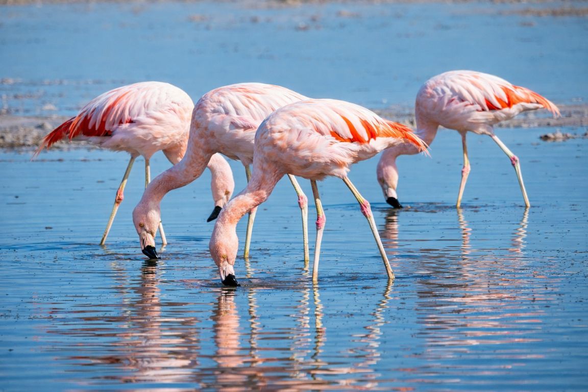
What is the Salar de Atacama, and how big is it really?
The Salar de Atacama is a vast closed salt basin covering roughly 3,000 square kilometres, the largest salt flat in Chile and the second largest in the world after Bolivia's Salar de Uyuni. It sits at about 2,300 metres, ringed by volcanoes, and its surface is a hard crust of jagged salt rather than a smooth white plain.
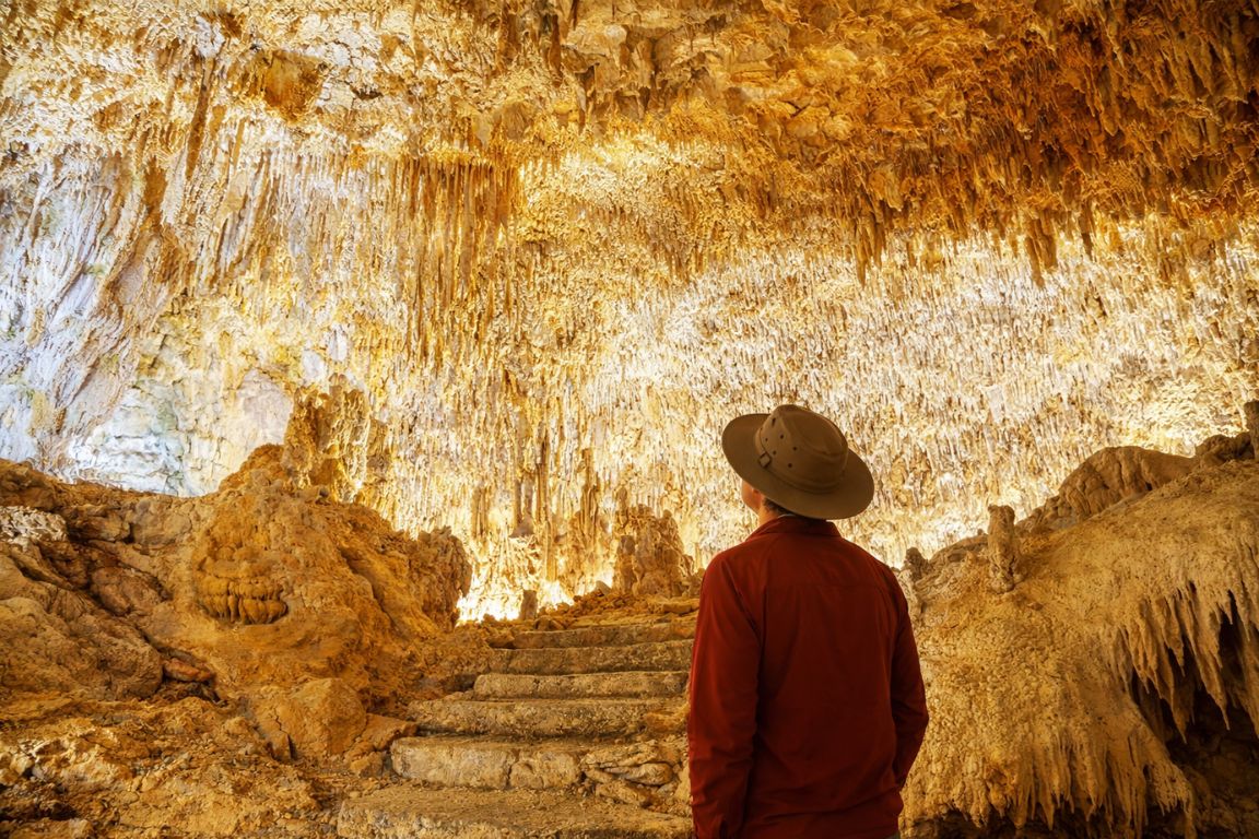
The first thing that surprises people is the texture. Photographs of salt flats train you to expect a mirror or a tiled white floor. The Salar de Atacama is neither. Its surface is a chaotic, broken crust of grey and brown salt pushed up into sharp ridges, closer to a frozen sea that has been shattered and refrozen than to anything smooth. Walking on it without a path would shred your shoes.
That roughness is a product of how the basin works. Water flows down from the Andes, dissolves minerals on the way, arrives here and has nowhere to leave. Evaporation in one of the driest places on the planet does the rest, precipitating salts out of solution year after year. What is left is metres of accumulated crust, and beneath it, brine.
That brine is why the salar matters far beyond tourism. It holds one of the world's most concentrated lithium reserves, and industrial extraction operates on the basin under state concessions. You will see the evaporation ponds from the air if you fly into Calama. Guides talk about it openly, because the tension between extraction, water tables and the flamingo habitat you are about to visit is a live local issue rather than a historical one.
Compared with the salt flat everyone crosses the border to see, this one is rougher, drier and less photogenic in the obvious way. If you are weighing up both, our comparison of the Atacama salt flat against Uyuni is honest about which does what.
Decide Whether You Want Chaxa Or The Whole Circuit
Choose what you want and the time you can give it. The result explains the trade-off before you open the booking page.
What is Laguna Chaxa, and where does it sit in the reserve?
Laguna Chaxa is a shallow brine lagoon on the eastern side of the Salar de Atacama, inside the Soncor sector of the Los Flamencos National Reserve. It is the main and most accessible flamingo-watching site in the region, with a short marked circuit, an interpretation point, and a manned entrance where fees are collected.
Los Flamencos is not a single block of land. It is a national reserve split into several separate sectors scattered across the region, taking in salt flats, lagoons and parts of the valleys near San Pedro. Chaxa is one sector, the altiplanic lagoons at Miscanti and Miñiques are another, and Valle de la Luna sits inside a third. The reserve is administered by Chile's national forestry corporation in a co-management arrangement with the Atacameña community of Toconao, which runs the site day to day.
That co-management is visible when you arrive. The ticket desk, the guides on the path, and the small interpretation area are staffed locally. Entry is paid, and your tour operator will normally have that fee bundled into the price, so check the listing rather than assuming.
The lagoon itself is not deep and not large. What makes it work is that the water is shallow enough for flamingos to feed and salty enough to support the tiny crustaceans they filter out of it, in a basin where usable water is scarce. Concentrate the food and the birds concentrate too.
Which flamingo species will you actually see?
Three species are documented in the area: the Chilean flamingo, the Andean flamingo and James's flamingo, also called the puna flamingo. The Chilean is the one you will almost certainly see, being the most numerous and the most tolerant of a range of conditions. The other two appear less predictably, and numbers shift through the year.
Telling them apart from the viewing points takes a moment, and guides usually run through it before releasing everyone onto the path. The differences are in leg colour, bill pattern and the shade of the plumage, which are all easier to check on a photograph afterwards than through squinting eyes in bright glare.
| Species | Size | Leg colour | Bill | Field mark to look for |
|---|---|---|---|---|
| Chilean flamingo | Largest of the three | Greyish with pink or red joints | Pale with a black tip over roughly the outer third | Grey legs with distinctly pink knees, the easiest tell |
| Andean flamingo | Large | Yellow | Pale with an extensive black tip | Yellow legs and a broad band of black on the trailing wing |
| James's or puna flamingo | Smallest of the three | Brick red | Bright yellow with a small black tip | Vivid yellow bill, the most colourful head of the three |
All three are high-altitude specialists of the central Andes, and all three feed by filtering. That is where the pink comes from: pigments in the algae and small crustaceans they eat accumulate in the feathers. A pale, almost white flamingo is usually a young bird rather than a different species.
Do not expect a flock of a thousand birds standing shoulder to shoulder. Chaxa on a normal day gives you scattered groups across the shallows, sometimes a few dozen, sometimes a couple of hundred. Numbers rise and fall with water levels, breeding cycles and season, and no operator can promise a count.
When are the flamingos most active?
Early morning and late afternoon. Flamingos feed most actively when the temperature is moderate and the light is low, and they stand still through the harsh middle of the day. Tours that reach Chaxa around sunset usually see more movement, more feeding, and the occasional short flight between pools.
| Time of day | Bird activity | Light quality | Crowds at the site |
|---|---|---|---|
| Early morning, before 09:00 | Good, active feeding | Soft, low angle from the east | Light, most circuits have not arrived yet |
| Late morning to mid afternoon | Quietest, birds mostly standing | Harsh overhead glare off the crust | Variable |
| Late afternoon, from around 17:00 | Picking up again | Warming, long shadows on the crust | Building |
| Sunset hour | Most active of the day | The best of the day by a wide margin | Heaviest, several circuits converge |
This is why full-day southern circuits differ in where they place Chaxa. Some run it first thing, which gets you an empty site and quiet birds. Most save it for the end, which trades solitude for light and activity. Neither choice is wrong, but if photography is your reason for coming, the afternoon slot is the one to book.
Wind matters as much as time. On a still evening the shallows go glassy and reflect the volcanoes, which is the shot everyone wants. On a windy one the surface breaks up and the birds hunker down. Wind tends to build through the afternoon across the basin, so a calm sunset is luck rather than a plan.
The Direct Fit And Useful Alternatives
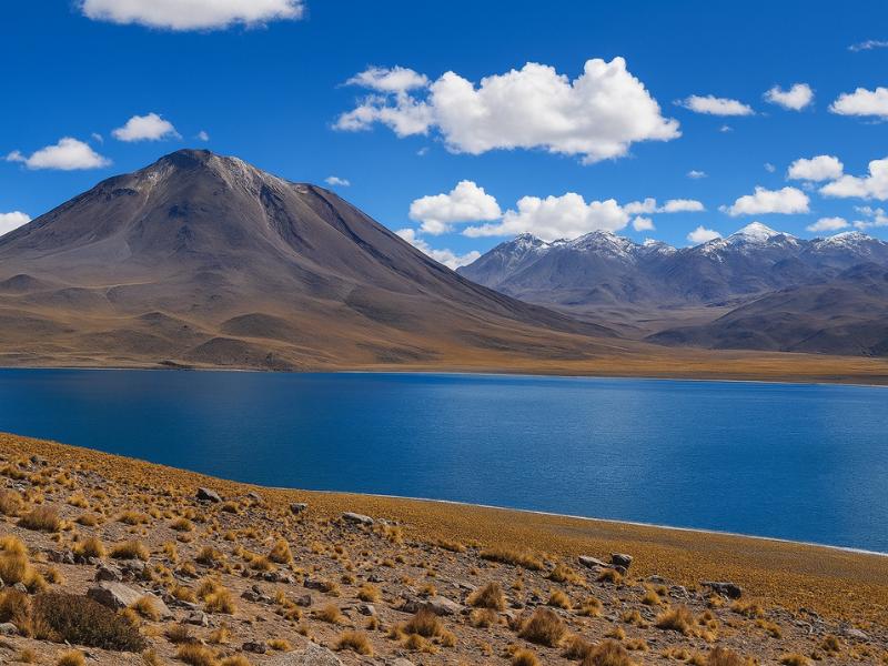
Piedras Rojas And Highland Lagoons
Give a full day to red rocks and highland lagoons without organizing the driving yourself. A connected circuit makes more sense than treating every stop as a separate trip.
A long, high-altitude outing; check participation requirements.
Book on ViatorSee The Piedras Rojas Route ↗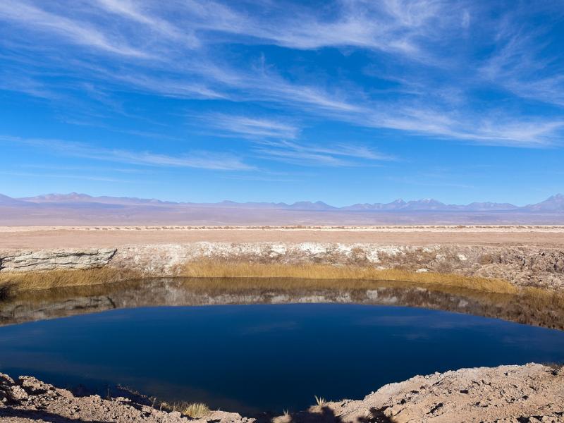
Laguna Cejar And Nearby Lagoons
Choose a lagoon outing for a change of pace from rocky valleys. This route combines Cejar with nearby Ojos del Salar and Tebenquiche.
About five hours. Bring sun protection; the itinerary and bathing access depend on current conditions.
Book on ViatorBook A Cejar Lagoon Outing ↗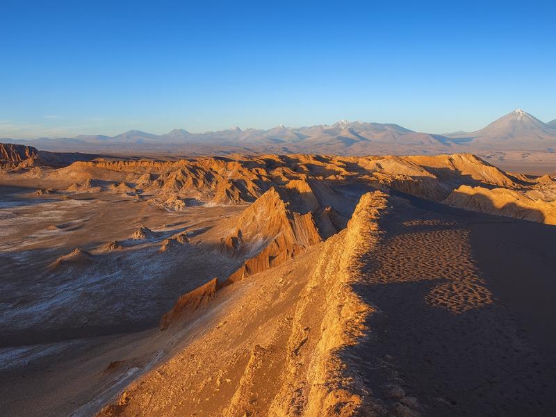
Valley Of The Moon
Make room for a desert landscape outing without committing several days. A guided Moon Valley excursion gives your afternoon a clear destination.
About four hours. Walking is involved; read the participation requirements.
Book on ViatorSee Moon Valley Departures ↗Why does the light at Chaxa matter more than at other stops?
Because the subject is white salt, pale water and pink birds, all of which need low, angled light to separate. In flat midday sun the crust blows out to featureless white, the birds lose their colour, and the volcanoes behind them go hazy. At sunset the crust picks up texture and the whole scene gains depth.
The geometry helps. Chaxa faces a horizon of volcanoes, including Licancabur to the north, so the last hour of sun throws warm side light across a landscape that is otherwise almost entirely reflective. Salt is a mirror. Give it a low sun and every ridge on the crust casts a small shadow, and a surface that looked like a blank sheet suddenly looks like terrain.
There is a second, quieter reason. Sunset at Chaxa is when the site is at its most atmospheric on the ground, not just in the camera. The temperature drops fast, the wind often settles, the day's traffic thins, and the birds start calling. Several of our travellers describe it as the calmest 45 minutes of the entire circuit.
If you want the same last-light effect closer to town and without a full day out, the salt lagoons at Laguna Cejar run sunset departures that end with a drink beside the water at Tebenquiche, on the opposite edge of the same salar.
How high is Chaxa, and why is that a relief?
Chaxa sits at roughly 2,300 metres, slightly lower than San Pedro de Atacama itself. On a circuit that spends the middle of the day above 4,000 metres, it is the one stop where the air is thick, the walking is flat, and nobody has to think about altitude at all.
| Stop | Approximate altitude | Altitude relative to San Pedro | Effort required |
|---|---|---|---|
| Laguna Chaxa | Around 2,300 m | Slightly lower | Flat, short marked circuit |
| San Pedro de Atacama | 2,400 m | Baseline | Town level |
| Toconao | 2,500 m | Marginally higher | Village streets |
| Socaire | Around 3,500 m | Over 1,000 m higher | Short walks feel harder |
| Miscanti and Miñiques | Around 4,100 m | Around 1,700 m higher | Slow walking, cold and wind |
| Piedras Rojas, Salar de Talar | Just above 4,000 m | Around 1,600 m higher | Short viewpoint walk, thin air |
That makes Chaxa unusual among the region's headline sights: it is genuinely suitable for day one. Travellers who land in Calama, drive to San Pedro and want to see something real without gambling on how they will react to altitude can do this without any concern. It is also the stop that works for older travellers and small children who would struggle higher up.
Operators use that fact deliberately. Placing Chaxa at the end of the southern circuit means the group descends from 4,000 metres and immediately gets an easy, low, flat stop, which is exactly when headaches ease. The ordering logic behind the whole region is set out in our altitude and tour order guide.
What are the rules on the ground at Laguna Chaxa?
Stay on the marked path, keep your distance from the birds, do not touch or walk on the salt crust, no drones, no swimming, and no feeding anything. The circuit is short and clearly signed, staff monitor it, and the restrictions exist because the lagoon is breeding and feeding habitat inside a protected reserve.
None of this is decorative. Flamingos are sensitive to disturbance while feeding, and a person who steps off the path to get closer will move every bird in that pool. Multiply that by the number of visitors arriving daily and the birds simply stop using the accessible pools, which is how sites like this quietly ruin themselves.
| Rule | Why it exists |
|---|---|
| Stay on the marked circuit | Protects nesting and feeding areas and stops crust damage |
| Keep well back from birds | Flamingos flush easily and abandon feeding when approached |
| No swimming or wading | Protected habitat, and the brine is hostile to skin and eyes |
| No drones | Aerial disturbance is severe for flocking birds |
| Entrance fee payable at the gate | Funds site management and the local community that runs it |
| Pack out everything | No waste infrastructure on the salar |
| Follow staff instructions on closures | Sections close during sensitive breeding periods |
Sections of the circuit are occasionally closed at short notice. That is normal and it is a good sign, not a bad one. It means the site is being managed for the birds rather than the queue.
Which tours include Laguna Chaxa?
Every full-day southern circuit from San Pedro finishes or starts at Chaxa, and all three of our full-day options include it. Chaxa is rarely sold alone because it sits an hour from town on the same road as Toconao, Socaire and the high lagoons, so operators bundle the whole route into one day.
| Tour | Listed price | Length | Rating | Where Chaxa sits in the day |
|---|---|---|---|---|
| Piedras Rojas, Altiplanic Lagoons & Chaxa Full-Day | $110 | 10 hours | 4.9 from 3,929 bookings | Combined with Toconao and the Tropic of Capricorn marker |
| Red Stones, Altiplánicas & Chaxa Experience | $120 | 12 hours | 4.9 from 1,346 bookings | Longest day, breakfast and lunch both included |
| 3-in-1: Red Stones, Highland Lagoons & Chaxa | $85 | 11 hours | 4.7 | Small group capped at 14, lowest listed price |
Prices shift with season and availability, so treat these as the current listings and confirm on the live page. If you are building a longer stay, Chaxa also appears inside the multi-day packages that combine the southern circuit with El Tatio, Valle de la Luna and the salt lagoons.
Worth knowing: because Chaxa is the last stop on most itineraries, a late-running day compresses it. If the flamingos are your priority rather than the red rocks, say so to your guide at pickup. They can often protect the time.
What does the salt crust actually look and feel like up close?
Sharp, brittle and much darker than photographs suggest. The surface is a lattice of upturned salt plates, grey-brown from dust and mineral staining, that crunches loudly underfoot on the marked path. Fresh white salt shows only where brine has recently evaporated at the pool edges.
People arrive expecting Uyuni's flat white mirror and briefly wonder whether they are in the right place. They are. The two salt flats formed under different conditions, and the Atacama basin's crust has been building and buckling for far longer without the seasonal flooding that resurfaces Uyuni into a sheet.
Get close to a pool edge and the difference is obvious. The rim is bright, almost sugary white, where evaporation has left a fresh deposit. A metre back, the crust is old, grey and pitted. Guides often point out crystal formations along the path, and they are worth stopping for, because the geometry of salt growth is genuinely strange up close.
The other sensory detail nobody mentions in advance is sound. On a still evening at Chaxa the loudest thing is the crust ticking as it cools and contracts, punctuated by flamingo calls. It is a very quiet place, and standing still for a couple of minutes rather than photographing constantly is the part most people remember.
Choose A Date For Your Outing
Piedras Rojas And Highland Lagoons
Select your date and party on Viator for the current price and departure options.
See The Piedras Rojas Route ↗What should you bring for photography and comfort?
A long lens if you own one, sunglasses, wind protection and something warm for after sunset. The birds keep their distance, the glare off white salt is severe, and the temperature at the salar drops quickly once the sun is off the horizon, even on a hot day.
| Item | Why it matters at Chaxa specifically |
|---|---|
| Telephoto lens or zoom | Birds stay well out on the shallows and the path keeps you back |
| Polarising filter | Cuts reflection off brine and deepens the sky over white crust |
| Sunglasses | Glare from salt is worse than glare from sand or snow |
| Warm layer and windbreak | Temperature falls sharply in the half hour after sunset |
| Closed shoes | The crust is abrasive and the path is uneven in places |
| Water | Very dry air, and the stop often comes at the end of a long day |
| Spare camera battery | Cold and long shooting sessions drain cells faster than expected |
| Cash in pesos | Useful if your tour does not include the reserve entry |
Binoculars turn this stop from good to excellent, and almost nobody brings them. If you can borrow a pair, do. Full kit advice for the region is in our Atacama packing guide.
When is the best month to see flamingos at Chaxa?
Flamingos are present year round, so there is no month that fails. Numbers and behaviour shift with water levels and breeding cycles rather than with the tourist calendar, and the practical differences between seasons are more about your own comfort and the reliability of the weather on the rest of the circuit.
| Period | Conditions on the salar | What it means for the visit |
|---|---|---|
| December to February | Warmest days, altiplanic storms building over the mountains inland | Dramatic skies behind the volcanoes, but the high half of the circuit can be disrupted |
| March to May | Settled and clear, cooling | Reliable sunsets, comfortable temperatures, generally excellent |
| June to August | Coldest, sharpest visibility, hard frosts overnight | Superb clarity for volcano backdrops, bring serious layers for sunset |
| September to November | Windy and warming | Wind can break up reflections, otherwise strong conditions |
Because Chaxa is low, it stays viable when the high stops do not. On days when snow or storms shut the road above Socaire, operators reroute and the salt flat is usually still on the programme. The full seasonal picture for the region sits in our best time to visit guide and the month-by-month detail in the seasonal comparison.
Is Chaxa worth it if you have seen flamingos before?
Yes, but adjust what you are coming for. If you have watched flamingos in a zoo or on a warm coastal lagoon, the birds themselves will not shock you. What is different here is the setting: three Andean species feeding on a lithium-rich brine pool in the middle of a 3,000 square kilometre salt basin, ringed by 5,000 metre volcanoes.
Travellers who come purely for a bird count sometimes leave underwhelmed, particularly at midday when the flock is standing still in flat light. Travellers who come for the place, and treat the flamingos as the living part of a very strange landscape, almost never do.
It also functions as the emotional counterweight to the rest of the circuit. Piedras Rojas and the altiplanic lagoons are spectacular and completely lifeless. Arriving at Chaxa after six hours of sterile high desert, and finding several hundred large birds feeding in it, changes how the whole day reads.
One honest caveat: this is a busy site at sunset. Several vehicles arrive within the same half hour and the path is not long. If solitude matters more to you than light, ask for a departure that runs Chaxa in the morning instead.
How does Chaxa fit into a wider Atacama itinerary?
Treat it as either the low, easy end of the southern full-day circuit, or as a gentle first outing while you are still adjusting to 2,400 metres. It does not need to be your priority booking, because almost every full-day southern tour includes it by default.
On a three or four day trip, the usual pattern places the low valleys and salt lagoons early, the southern circuit with Chaxa in the middle, and El Tatio or a high climb at the end. Our 3 to 4 day classic itinerary follows that logic, and the longer version in five days in Atacama adds room for a second sunset on the salar.
Budget travellers should note that Chaxa comes bundled with a long day out, so there is no cheap standalone way to reach it without a vehicle. If cost is the constraint, our list of budget-friendly activities around San Pedro covers what is genuinely reachable on foot or by bike.
The last practical point is timing your booking. Full-day southern circuits fill in high season, particularly the departures that reach Chaxa at sunset, and walk-up availability is unreliable in January and February. The trade-offs between booking ahead and improvising on arrival are set out in booking tours in advance or on arrival.
Make It Part Of Your Trip
The full circuit names Chaxa alongside Piedras Rojas and the highland lagoons. The whole route, not Chaxa alone, determines its demands.
Piedras Rojas And Highland Lagoons
Give a full day to red rocks and highland lagoons without organizing the driving yourself. A connected circuit makes more sense than treating every stop as a separate trip.
See The Piedras Rojas Route ↗