Lagunas Altiplánicas: Miscanti and Miñiques Guide
Two deep blue lagoons sit above 4,000 metres behind the volcanoes south of San Pedro, separated by an old lava flow and surrounded by vicuñas. For most visitors this is the highest they have ever stood, and the wind makes sure they notice.
What are the Lagunas Altiplánicas?
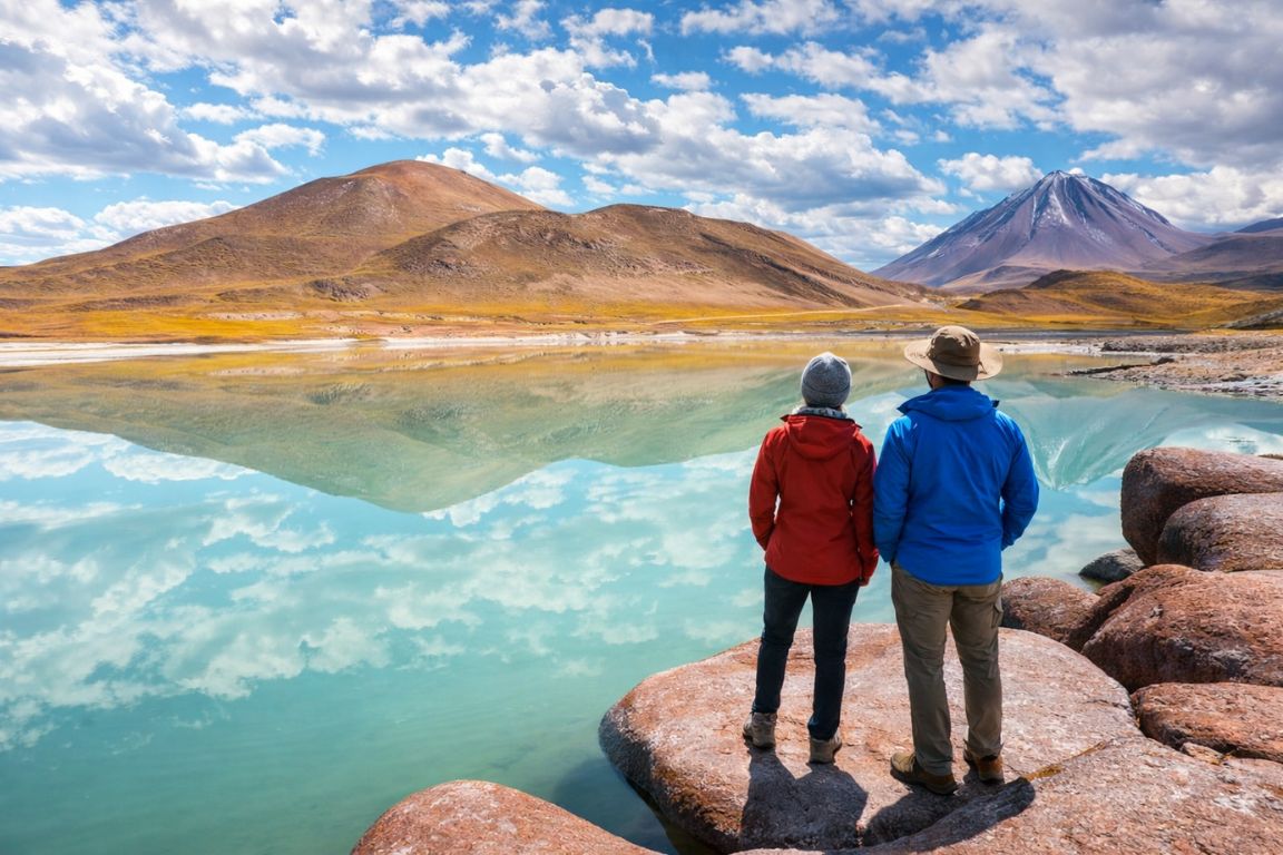
Lagunas Altiplánicas is the name given to the pair of high-altitude lakes at Miscanti and Miñiques, sitting above 4,000 metres in the Andean plateau south-east of San Pedro de Atacama. They are closed brackish lakes inside the Los Flamencos National Reserve, managed by Chile's national forestry corporation, reached by a gravel spur off the road that climbs past Socaire.
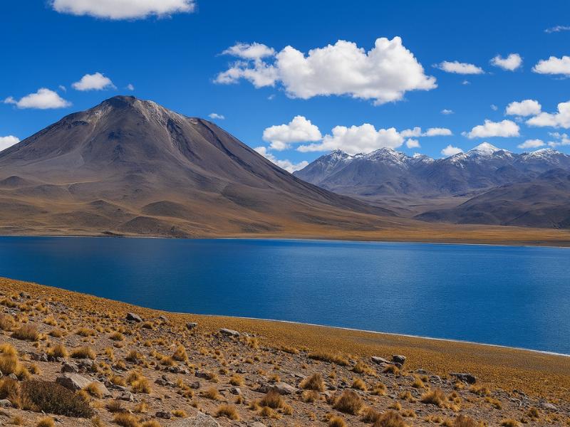
Miscanti is the larger of the two, a broad sheet of hard blue water held in a bowl below the Miscanti and Miñiques volcanoes. Miñiques is the smaller, tucked behind a ridge a few minutes further along the track. Neither has an outlet. Water arrives from snowmelt and springs, and leaves only by evaporation, which is why both are brackish rather than fresh.
The colour is the thing everyone comments on. It is a dense, almost artificial blue, sharper than the sky above it, held against pale straw-coloured grassland and dark volcanic rock. That contrast has nothing to do with minerals in the water and everything to do with depth, clarity and the thin atmosphere at 4,100 metres, which scatters far less light than air at sea level.
The setting is silent in a way that catches people off guard. Very little grows, almost nothing moves apart from vicuñas and the wind, and there is no infrastructure beyond a small parking area, a marked path and a ranger point. That emptiness is the experience as much as the water is.
Book The Lagoons As A Connected Day
Choose what you want and the time you can give it. The result explains the trade-off before you open the booking page.
How high are Miscanti and Miñiques, and what does that do to you?
Both lagoons sit at roughly 4,100 metres. San Pedro de Atacama is around 2,400 metres, so reaching them means gaining more than 1,700 metres inside a vehicle in under three hours. At that height the air holds roughly 60 per cent of the oxygen it does at sea level, and almost everyone notices it within a few steps.
The symptoms are usually mild and universal rather than dramatic. Breathlessness climbing the short rise from the car park. A tight forehead. Slight dizziness when you stand up after crouching for a photograph. A strange emotional flatness that some travellers mistake for disappointment with the view.
| Location | Approximate altitude | Approximate oxygen available | What most visitors feel there |
|---|---|---|---|
| Sea level, for reference | 0 m | 100 per cent | Baseline |
| San Pedro de Atacama | 2,400 m | Around 75 per cent | Mild breathlessness on arrival, gone within a day or two |
| Socaire | Around 3,500 m | Around 65 per cent | Noticeable on stairs and slopes |
| Lagunas Miscanti and Miñiques | Around 4,100 m | Around 60 per cent | Slow walking, headaches for some, cold felt more sharply |
| El Tatio geyser field | Around 4,300 m | Just under 60 per cent | Similar, compounded by a pre-dawn start |
| Cerro Toco summit | 5,604 m | Around 50 per cent | Serious effort, only after full acclimatisation |
The single most useful thing you can do is drink water from the moment you are picked up, well before you feel thirsty. The second is to walk deliberately slowly at the lagoons, which feels ridiculous for the first 20 metres and sensible for the rest. The third is to eat, even without appetite, because low blood sugar and thin air produce a headache that neither one would cause alone.
Guides on this route carry oxygen and know what altitude sickness looks like better than you do. Tell them if you feel unwell rather than sitting quietly in the van hoping it passes. The full ordering logic for the region is in our altitude and tour order guide, and it is the single most useful thing to read before booking anything high.
Why do the two lagoons look so different?
They were one body of water until a lava flow from the Miñiques volcano cut across the basin and split it in two. Miscanti is much the larger and sits in an open bowl with long views. Miñiques is smaller, deeper set, and hemmed in by rock, which gives it a darker, more enclosed character.
Standing at the Miscanti viewpoint, the scale reads as horizontal: a wide blue plane, a low shore of pale grass, volcanoes rising behind. Walk or drive the few minutes to Miñiques and the composition flips to vertical, with rock walls close to the water and the lagoon sitting in shadow for more of the day.
| Feature | Laguna Miscanti | Laguna Miñiques |
|---|---|---|
| Relative size | Considerably larger | Small |
| Setting | Open bowl, long sightlines | Enclosed by rock, more sheltered |
| Typical colour | Bright, hard blue in full sun | Darker blue, more shadow |
| Time given on tour | Most of the stop, main viewpoint | A shorter look, sometimes from the vehicle |
| Wind exposure | High, very little shelter | Somewhat more sheltered |
| Best for | Wide landscape shots, vicuña sightings | Reflections and closer compositions |
Because they sit within a couple of kilometres of one another, tours treat them as a single stop. If your operator is running behind, Miñiques is usually what gets shortened, so mention it at pickup if the smaller lagoon matters to you.
How cold and windy is it, even in summer?
Far colder than San Pedro, in every month. As a working rule, subtract roughly 10 degrees from the town forecast for 4,100 metres, then account for wind that regularly strips several more. Travellers arrive in January in shorts and are back in the van within ten minutes, genuinely shocked.
The wind is the part people underestimate. There is no shelter at the Miscanti viewpoint, no trees, no buildings and no lee side, and the plateau funnels air across open water. On a bad afternoon the wind chill at the lagoons is the coldest thing most visitors experience on their entire Chile trip, and it usually happens on a day the thermometer in town read 25 degrees.
| Period | Typical daytime feel at 4,100 m | Wind | What to wear |
|---|---|---|---|
| December to February | Cool to cold in sun, cold in shade | Moderate, storms possible in the afternoon | Fleece plus windproof shell, hat |
| March to May | Cold, clear and settled | Usually lighter | Warm mid layer, shell, gloves |
| June to August | Very cold, sub-zero possible in daylight | Bitter when it blows, snow possible | Full winter kit including hat and gloves |
| September to November | Cold, warming through the season | The windiest months of the year | Windproof shell is the priority item |
Snow on the plateau can close the road above Socaire for a day or two in winter, and afternoon storms in the January and February altiplanic wet season occasionally do the same. Operators cancel or reroute when that happens, which is the right call. The wider seasonal picture is in our best time to visit guide and the month-level detail in the seasonal comparison.
The Direct Fit And Useful Alternatives
Piedras Rojas And Highland Lagoons
Give a full day to red rocks and highland lagoons without organizing the driving yourself. A connected circuit makes more sense than treating every stop as a separate trip.
A long, high-altitude outing; check participation requirements.
Book on ViatorSee The Piedras Rojas Route ↗
Laguna Cejar And Nearby Lagoons
Choose a lagoon outing for a change of pace from rocky valleys. This route combines Cejar with nearby Ojos del Salar and Tebenquiche.
About five hours. Bring sun protection; the itinerary and bathing access depend on current conditions.
Book on ViatorBook A Cejar Lagoon Outing ↗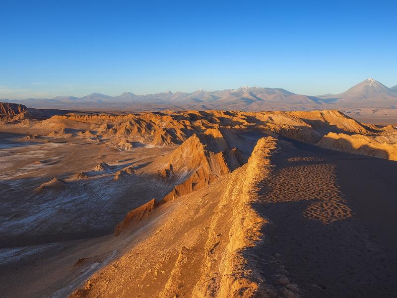
Valley Of The Moon
Make room for a desert landscape outing without committing several days. A guided Moon Valley excursion gives your afternoon a clear destination.
About four hours. Walking is involved; read the participation requirements.
Book on ViatorSee Moon Valley Departures ↗What is the walk like at the lagoons?
Short and near level. From the parking area a marked path runs along the shoulder above Laguna Miscanti to a viewpoint, taking most people 10 to 20 minutes at an unhurried pace. The ground is easy. The altitude is what makes it feel like more than it is.
Nobody needs hiking experience here. Closed shoes are plenty, poles are unnecessary, and the elevation gain on the path itself is negligible. What you will notice is that a walk you would not register at home leaves you slightly out of breath, which is a normal and useful reminder of where you are.
| Aspect | What to expect |
|---|---|
| Total time at the stop | Typically 45 to 60 minutes for both lagoons |
| Path surface | Compacted gravel and grit, marked and obvious |
| Gradient | Gentle, no climbing involved |
| Footwear | Closed shoes or trainers are enough |
| Shade | None |
| Toilets | Very basic if present, plan around Socaire and Toconao |
| Phone signal | Assume none |
| Swimming | Not permitted, protected water inside the reserve |
Access is controlled by the reserve, with a ranger point and an entry fee that most operators include. Paths and viewpoints can be adjusted or partially closed for conservation reasons, so follow whatever the signage and staff say on the day rather than what a blog post from three years ago showed.
What wildlife lives around Miscanti and Miñiques?
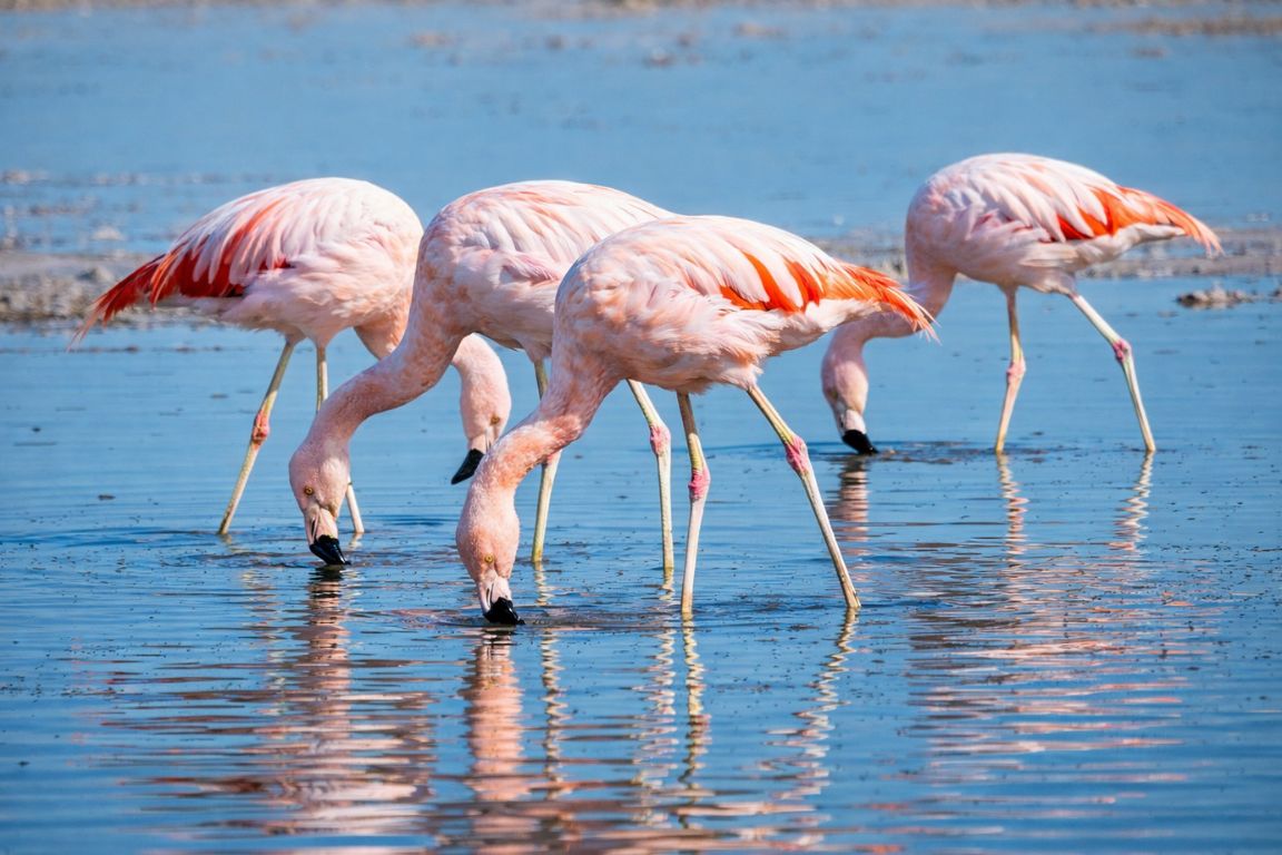
Vicuñas are the animal you are most likely to see, often grazing in small family groups on the pale grassland near the shore. Andean gulls, giant coots and other high-altitude waterbirds use the lagoons, and viscachas sometimes appear among the rocks. Flamingos are not the draw here, unlike at Chaxa.
Vicuñas are wild relatives of the llama and alpaca, smaller and finer than either, with a distinctive pale chest and an extremely fine fleece. They were hunted close to extinction and are now protected, and the population across the Chilean altiplano has recovered enough that sightings on this route are common rather than lucky.
| Species | Where you tend to see it | Likelihood on a normal visit |
|---|---|---|
| Vicuña | Grassland around the lagoon shores and along the access track | High |
| Andean gull | On and above the water | Moderate |
| Giant coot | Shallow margins of the lagoons | Moderate |
| Viscacha | Rocky ground and boulder fields | Low, requires patience and luck |
| Andean fox | Along the roadside, usually a glimpse | Low |
| Flamingos | Occasionally on the lagoons, far more reliably at Chaxa | Low here, high at Chaxa |
Keep your distance and do not feed anything. Vicuñas look approachable and are not, and habituating wild animals to vehicles and food is exactly how a protected population starts having problems. If birds are your priority, the reliable stop is Laguna Chaxa on the Salar de Atacama, which sits at the low end of the same circuit.
Who should not attempt this on their first day?
Anyone who flew into Calama within the last 24 hours, anyone with an untreated heart or lung condition, and anyone who has previously reacted badly to altitude. The lagoons are not dangerous in themselves, but they are two hours of driving from thick air, which removes the option of coming down quickly.
The usual pattern of trouble is not dramatic. Someone arrives from sea level, books the highest available tour for their first morning because it looked the best, and spends the day with a splitting headache and nausea, remembering none of it. They did not do anything reckless. They just skipped the two nights at 2,400 metres that would have made the day enjoyable.
Give San Pedro at least two nights first, and spend them on low activities: the Valle de la Luna at around 2,500 metres, the salt lagoons, the village itself. Then the plateau is a pleasure rather than an ordeal.
Families should weigh the sitting time as carefully as the height, and our guide to travelling in Atacama with kids is honest about which ages cope. Older travellers with cardiovascular history should get clearance from a doctor at home, not make the call in a hotel lobby, and the practical detail is in Atacama for senior travellers. Pregnancy, recent surgery and poorly controlled asthma all warrant a proper medical conversation before booking.
Which tours visit the altiplanic lagoons?
All three of our full-day southern circuits include Miscanti and Miñiques, along with Piedras Rojas, Chaxa and at least one village stop. Nobody sells the lagoons alone, because they sit two and a half hours out on a road that passes everything else worth stopping for.
| Tour | Listed price | Length | Rating | Notes on the lagoon stop |
|---|---|---|---|---|
| Piedras Rojas, Altiplanic Lagoons & Chaxa Full-Day | $110 | 10 hours | 4.9 from 3,929 bookings | Shortest full circuit, also takes in Toconao and the Tropic of Capricorn marker |
| 3-in-1: Red Stones, Highland Lagoons & Chaxa | $85 | 11 hours | 4.7 | Group capped at 14, quicker loading at each viewpoint |
| Red Stones, Altiplánicas & Chaxa Experience | $120 | 12 hours | 4.9 from 1,346 bookings | Longest day, breakfast and lunch both included |
Listed prices move with season and demand, so check the live page before booking. Group size is worth thinking about on a stop this exposed: a smaller van gets everyone out, up the path and back in before the cold becomes a problem, which is not always true of a full bus.
If you want to run the circuit on your own schedule, stopping longer at Miñiques or waiting out cloud, the trade-offs are covered in private tours against group departures.
Choose A Date For Your Outing
Piedras Rojas And Highland Lagoons
Select your date and party on Viator for the current price and departure options.
See The Piedras Rojas Route ↗Can you visit the lagoons independently?
You can drive there, but it is a long day on a road that turns to gravel, at an altitude that degrades both engine performance and your own judgement, with no fuel south of Toconao and no phone signal after Socaire. Entry is controlled at a ranger point with a fee payable on arrival.
Plenty of people do it in a rental car and enjoy it. The honest points against are that many rental agreements restrict unsealed roads, that recovery from a breakdown is measured in hours, and that the drive up eats the time you thought you were saving. A tour costs less than fuel plus fees plus a day of the car in high season for two people.
There is also a subtler argument. On the guided version, someone else drives while you look out of the window at the highest landscape you have ever crossed, and that person can tell you what you are looking at. Our balanced view sits in guided tours or self-drive, with practical routes in the do-it-yourself tour guide.
What should you wear and carry at 4,100 metres?
Layers, a genuine windproof shell, a hat, sun protection and water. The temperature swing across a single day on this circuit is larger than most travellers ever experience, running from near freezing at dawn to hot at the villages and back to bitter at the lagoons within nine hours.
| Item | Why it matters here |
|---|---|
| Windproof jacket | The single most useful item, there is no shelter at Miscanti |
| Warm mid layer | Fleece or light down, worn and removed several times a day |
| Hat and gloves | Extremities suffer first in wind at altitude, in every season |
| High-factor sunscreen | Ultraviolet intensity rises sharply with altitude and thin air |
| Sunglasses | Glare off water and pale ground is severe at this height |
| Two litres of water | Hydration is the most effective altitude precaution you control |
| Snacks | Appetite drops with height, but you still need the calories |
| Lip balm | Wind plus dryness plus ultraviolet cracks lips within hours |
| Cash in pesos | Village stalls and small purchases along the route |
Bring the warm layer even when the town forecast looks hot, and keep it accessible rather than buried in a bag in the back of the van. The full regional kit list is in our Atacama packing guide.
How do the lagoons compare with the other stops on the same day?
Miscanti and Miñiques are the quietest and most austere stop on the circuit, and the one people most often name as their favourite afterwards. Piedras Rojas has the stronger colours, Chaxa has the wildlife, and the villages have the human interest, but the lagoons have the scale and the silence.
| Stop | Altitude | Time you get | What it delivers |
|---|---|---|---|
| Lagunas Miscanti and Miñiques | Around 4,100 m | 45 to 60 min | Deep blue water, vicuñas, total silence, the highest walk of the day |
| Piedras Rojas, Salar de Talar | Just above 4,000 m | 40 to 60 min | Red rock against white crust and turquoise brine, the colour highlight |
| Laguna Chaxa | Around 2,300 m | 45 to 60 min | Three flamingo species, easy walking, the best light of the day |
| Socaire | Around 3,500 m | 20 to 45 min | Stone terraces, village church, coffee, a useful altitude waypoint |
| Toconao | 2,500 m | 30 to 45 min | Bell tower, craft stalls, breakfast, reliable facilities |
Fitting this day into a wider trip is straightforward. On three or four days, put it third, after the low valleys and the salt lagoons, as laid out in our 3 to 4 day classic itinerary. On a longer stay, five days in Atacama leaves room to add a high climb afterwards, once the plateau has done its acclimatising work for you.
What do visitors most often get wrong about this stop?
They underdress, they walk too fast, and they expect a hike rather than a viewpoint. The lagoons reward slowness. Almost every complaint about this stop traces back to arriving cold, moving quickly and spending the 45 minutes uncomfortable instead of still.
The second recurring mistake is photographic. Deep blue water under a deep blue sky at high altitude confuses camera meters, and phone shots often come back washed out with the sky blown white. Exposing slightly darker than the camera suggests, and including some of the pale grass or dark rock in the frame for contrast, fixes most of it.
The third is expectation management around wildlife. Vicuñas are common but not guaranteed, and they will not pose. Nothing about a protected high-altitude reserve is on a schedule.
The last one is scheduling, again. This is a stop that punishes the unacclimatised more than any other on the circuit, because it comes with a walk attached. Two nights in San Pedro first, plenty of water, and a slow pace turn a hard 45 minutes into the part of Chile people talk about when they get home.
Make It Part Of Your Trip
Choose a connected route rather than organizing separate drives for the lagoons and red rocks.
Piedras Rojas And Highland Lagoons
Give a full day to red rocks and highland lagoons without organizing the driving yourself. A connected circuit makes more sense than treating every stop as a separate trip.
See The Piedras Rojas Route ↗