Pukara de Quitor: The Pre-Inca Fortress Above San Pedro
Three kilometres north of San Pedro, hundreds of stone enclosures climb a bare hillside above the river. People built here because this narrow green valley was worth defending, and in 1540 it was fought over.
What is a pukara, and what makes Quitor one?
A pukara is an Andean fortified settlement, usually built on a defensible slope or spur, with walls, terraces and clustered stone enclosures. Pukara de Quitor is one of the best preserved in northern Chile: an Atacameno hillside stronghold roughly 3 km from San Pedro, overlooking the river valley that made settlement here possible.
The word comes from Quechua and it means fortress. Across the Andes, structures of this kind appear in numbers during the centuries before Inca expansion, a period marked by competition between local groups over scarce land and water. They share a logic: high ground, restricted approaches, defensive walls, and living space stacked behind them.
Quitor fits that pattern exactly, and its position explains the whole site. Below it the San Pedro river runs through a narrow valley, one of the few places in this basin where water reaches the surface and things grow. In a landscape as dry as the Atacama, that corridor was not just useful, it was everything. A settlement that controlled the valley controlled the ability to live here at all.
What you see today is a slope covered in stone walls: enclosures, storage structures, defensive lines and the terracing that holds it together. Some walls stand at chest height, some are foot-high outlines. Consolidation work has stabilised parts of it, and marked paths and stairways now route visitors up the hill without walking through the archaeology.
Keep Quitor Independent, Add The Canyon If You Want
Choose what you want and the time you can give it. The result explains the trade-off before you open the booking page.
Who built Pukara de Quitor, and when?
The Atacameno people, also known as the Likan Antai or Lickanantay, who have lived in this basin for thousands of years. The fortress is generally dated to around the 12th century, built during a period when fortified hilltop sites were appearing across the southern Andes.
| Period | What was happening in the basin | What you can see connected to it |
|---|---|---|
| Roughly 800 BC to 500 AD | Settled village life in the oases, circular adobe architecture | Aldea de Tulor, a buried village of round adobe structures near San Pedro |
| Around the 12th century | Fortified hilltop settlements appear across the Andes | Pukara de Quitor itself, built and occupied |
| Mid-15th century | Inca expansion reaches the Atacama basin | Inca-period influence on the region, road networks through the desert |
| 1540 | Spanish forces move through the Atacama | The assault on Quitor, recorded in colonial accounts |
| 20th century onward | Archaeological study and protection | Consolidation of the walls, National Monument status, community management |
The site is protected as a Chilean National Monument, and heritage protection here is administered through the Consejo de Monumentos Nacionales. Day-to-day it is managed by the local indigenous community of Quitor, which is why the entry arrangements feel more like a village project than a state park. That is not an accident of funding. It reflects the fact that the descendants of the people who built this are still here.
For context on how deep occupation goes in this basin, Tulor is the useful comparison. It is a village of circular adobe structures much older than Quitor, largely swallowed by sand, and it shows a completely different way of living in the same landscape: open, unfortified, close to water. Something changed between the two, and Quitor is what the change looked like.
What happened here in 1540?
Spanish forces attacking south from Peru assaulted the fortress. Colonial accounts describe a force under Francisco de Aguirre, part of Pedro de Valdivia's expedition, taking Quitor against Atacameno defenders, with the defeated killed and beheaded and the heads displayed as a warning. It is the event the site is remembered for.
The military reality was brutal and lopsided. Horses and steel against a hillside fortress designed to resist attackers on foot. The defensive works at Quitor were built for a world of local conflict, and they were never going to hold against cavalry.
What matters for a visitor is that this is not distant abstraction. The Likan Antai community that manages the site today are the descendants of the people who lost it. You are walking through a place where a specific atrocity happened to specific people, whose relatives take your entry payment at the gate. That deserves the same register you would bring to any other memorial site: quiet, attentive, and not treating the walls as a backdrop.
The interpretation on site keeps the memory of that event alive deliberately rather than presenting the pukara as neutral ruins. Read what is posted. It is short, and it changes what the climb feels like.
What do you actually see on site today?
A stepped hillside of stone enclosures, defensive walls and terraces, threaded by a marked path and stairway that climbs to a viewpoint over the San Pedro river valley. Expect roughly an hour of walking, looking and reading, with the view from the top as the payoff.
| Element | What it is | Where on the hill |
|---|---|---|
| Entrance and interpretation area | Community-run access point with information about the site | Base, by the road |
| Lower enclosures | Dense clusters of stone-walled rooms and storage structures | Lower and middle slope |
| Defensive walls and terracing | The lines that made it a pukara rather than a village | Across the slope, most visible from the path |
| Stairway and marked route | Modern walkway routing visitors above the archaeology | From the base to the upper site |
| Upper viewpoint | Open ground with the valley, the oasis strip and the desert beyond | Top of the climb |
| River valley below | The green corridor of the San Pedro river, the reason for the site | Visible throughout the climb |
The view is what people remember. From the upper ground you look down on a thin ribbon of green cutting through an entirely brown basin, with the Salt Mountains to the west and the Andean volcanoes standing on the eastern horizon. The strategic logic of the place is instantly legible from up there in a way it is not from the car park.
Manage your expectations about the structures themselves. This is not Machu Picchu and it does not pretend to be. It is a dense, low, weathered field of stone walls that rewards attention rather than announcing itself. Ten minutes of reading before you climb makes an enormous difference to what you see.
The Direct Fit And Useful Alternatives
Catarpe Valley And Devil’s Throat By Bike
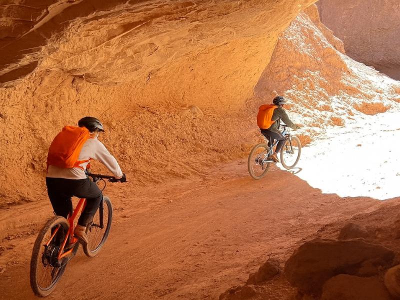
Follow a guided cycling route through Catarpe and Devil’s Throat, with a bicycle and safety equipment provided. Pay for the route knowledge as well as the bike.
Meeting point in central San Pedro. Off-road riding; entry charges are separate.
Book on ViatorRide Devil’s Throat ↗Rainbow Valley And Yerbas Buenas
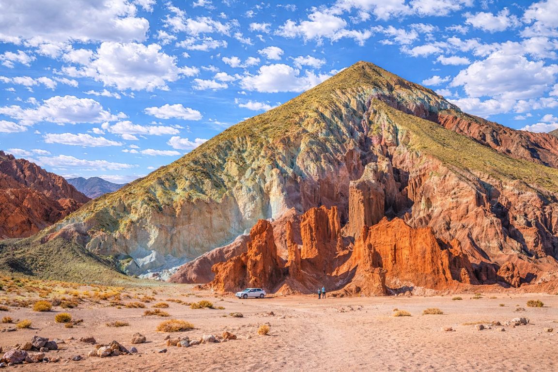
A guided outing pairing mineral-coloured hills with the Yerbas Buenas petroglyphs. Breakfast and hotel pickup are listed, with English and Spanish guiding.
Allow about six hours. Entrance tickets need arranging separately.
Book on GetYourGuideExplore Rainbow Valley And Rock Art ↗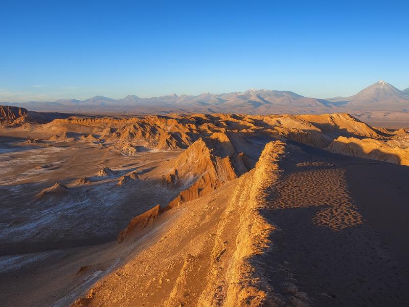
Valley Of The Moon
Make room for a desert landscape outing without committing several days. A guided Moon Valley excursion gives your afternoon a clear destination.
About four hours. Walking is involved; read the participation requirements.
Book on ViatorSee Moon Valley Departures ↗How hard is the climb, and how long does a visit take?
Allow about an hour on site, an hour and a half if you read everything and linger at the top. The climb is short but steep in sections, on stairs and a rocky path, at around 2,500 m. Most reasonably mobile people manage it with pauses.
| How you arrive | Travel time each way | Time on site | Realistic total |
|---|---|---|---|
| Walking from San Pedro | 40 to 55 min | 60 to 90 min | 2.5 to 3.5 hours |
| By bicycle from San Pedro | 15 to 25 min | 60 to 90 min | 1.5 to 2.5 hours |
| By taxi or car | About 10 min | 60 to 90 min | 1.5 to 2 hours |
| As part of a guided bike tour | Included in the route | About 60 min at the site | 4 hours for the whole outing |
| On horseback through the valley | Included in the route | Varies by operator | About 2 hours total |
The altitude does show up on the stairs. At 2,500 m you are breathing about three quarters of the air pressure you get at sea level, so a flight of steps that would be nothing at home leaves you puffing. That is entirely normal and it is not altitude sickness. Stop, breathe, look at the valley, carry on.
People with significant mobility limits can still get something out of the visit: the lower area and the interpretation are reachable without the full climb, and the valley is visible from partway up. Anyone with balance issues should be aware there are uneven rocky sections and open edges near the top.
How do you get there from San Pedro without a tour?
It is about 3 km north of town on the Quitor road, which makes it one of the few genuinely walkable sights in the Atacama. Walk it in 40 to 55 minutes, cycle it in 15 to 25, or take a short taxi ride. Carry cash for the community-managed entry.
Cycling is the sweet spot for most people. Bikes hire cheaply in San Pedro, the road out is flat and easy, and it gives you the option of carrying on into the Catarpe valley afterwards if you feel good. Hire details and the general transport picture are in getting around San Pedro.
Walking works if you go early. There is essentially no shade on the road, the sun at this altitude is fierce, and the return leg in midday heat is the part that spoils it. Leave shortly after sunrise, be at the fortress before the heat builds, and be back in town before midday.
Our advice on paying: bring small notes. This is a community-run site rather than a large ticketed attraction, and card facilities cannot be assumed. Our team does not publish an entry figure here because these things change and a wrong number is worse than none. Budget for a modest local entry fee and check on arrival. The wider cost picture for a trip is in trip costs and budgeting.
Can you combine Quitor with Devil's Throat and Catarpe?
Yes, and it is the standard pairing. The road past Quitor continues into the Catarpe valley and on toward Garganta del Diablo, so guided mountain bike tours stop at the fortress and then carry on into the canyon. The combination gives you archaeology, an oasis valley and a slot canyon in a single morning.
The pairing works intellectually as well as logistically. From the fortress terraces you look down the exact valley you then ride through. The strip of green below is the San Pedro river, the only reason any of this was habitable, and following it upstream into Catarpe shows you what the defenders of Quitor were protecting. That connection is hard to feel from a museum case.
The route, the surface conditions and what riding at this elevation actually feels like are covered in the Devil's Throat guide. If cycling is not for you, the horseback option covers the Catarpe and Chulacao canyons at a gentler pace, though it does not always include the fortress climb.
What is the best time of day to visit?
Early morning or late afternoon. Midday gives you flat light, no shade on an exposed hillside and the hardest heat of the day. First light and the last two hours before sunset both throw the stone walls into relief, which is when the terracing finally becomes readable.
| Time slot | Light | Heat | Visitor numbers | Verdict |
|---|---|---|---|---|
| Just after sunrise | Low, raking, excellent for the walls | Cool, the most comfortable climb | Very low | Best overall, especially if walking or cycling out |
| Mid-morning | Getting harsh | Warming fast | Moderate, guided bike tours arrive | Good, still comfortable |
| Midday | Flat and washed out | Peak, no shade | Lower, most tours have moved on | Avoid |
| Late afternoon | Warm, low, strong shadows | Easing | Low | Excellent for photographs |
| Sunset | Beautiful, brief | Dropping quickly | Low | Check closing time first, and carry a layer |
Do not assume the site is open outside daylight hours, and do not plan to be on the hill after dark. Closing arrangements are set locally and they change. If a sunset visit matters to you, confirm the day's hours in town before you set off rather than riding out on an assumption.
Seasonally, any month works, because this is a low-altitude, short-duration visit that does not depend on clear high-country weather. Winter mornings are cold enough to want gloves on a bicycle. Summer midday is genuinely punishing on an unshaded slope. The broader seasonal picture is in the best time to visit.
Choose A Date For Your Outing
Catarpe Valley And Devil’s Throat By Bike
Select your date and party on Viator for the current price and departure options.
Ride Devil’s Throat ↗How do you visit a heritage site respectfully?
Stay on the marked paths and stairway, do not climb on or sit on the walls, take nothing from the ground, and keep noise down. Every stone here was placed by someone whose descendants manage the site today, and the structures survive because visitors are routed above them rather than through them.
- Paths and stairs only. The walkway exists precisely so foot traffic does not erode the archaeology. Shortcuts across the slope destroy what you came to see.
- Do not climb on walls. They are dry stone, unmortared and centuries old. Sitting on one for a photograph can dislodge it.
- Nothing leaves with you. Not a pottery fragment, not a stone. Removing material from a National Monument is illegal, and the fragment means nothing out of context anyway.
- Ask before photographing people, including community staff.
- Drones need permission. Do not assume, and do not fly first and ask afterwards.
- Read the interpretation. The 1540 events are part of what this place is, and the community chose to keep telling that story.
- Pack out everything, including fruit peel, which does not break down meaningfully in this climate.
The same standard applies at the other protected places around San Pedro, from Valle de la Luna to the flamingo reserve at Laguna Chaxa. Nothing here regenerates quickly. In a basin where measurable rain can be years apart, damage is effectively permanent.
How does Quitor compare with the other archaeology nearby?
Quitor is the fortified, defensive, late-period site. Tulor is the older, open village. The Catarpe valley holds later colonial-era traces. Together they show three different answers to the same question of how to live in a basin with almost no rain.
| Site | Roughly what period | What it is | Effort to visit |
|---|---|---|---|
| Pukara de Quitor | Around the 12th century onward | Hillside stone fortress, National Monument | 3 km from town, a short steep climb |
| Aldea de Tulor | Far older, roughly 800 BC to 500 AD | Circular adobe village, largely buried by sand | A short drive from town, flat |
| Catarpe valley | Later, including colonial period | Oasis corridor with historic traces along the river | Reached by bike or horse from town |
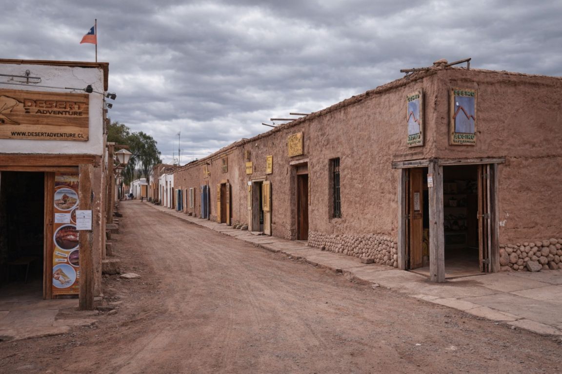
| San Pedro town centre | Colonial and later | Adobe streets and the historic church | On foot, no effort |
If you only do one, do Quitor. It is the closest, the most visually striking and the easiest to reach under your own power, and the view from the top explains the geography of the whole basin. If archaeology genuinely interests you, spread Quitor and Tulor across two mornings, because they answer each other.
Quitor also solves a practical problem in an Atacama itinerary. Most days here involve a van, a long drive and a fixed schedule. This is a half-day you can do on foot or by bike, at your own pace, on your own timing, at town altitude. That makes it the ideal second-day activity while you acclimatise for the higher trips, a point covered in the altitude and tour order guide.
Which tours include Pukara de Quitor?
The mountain bike route to Devil's Throat stops at the fortress as a matter of course. The horseback ride works the same valleys at a gentler pace. Neither is a dedicated archaeology tour, because the site is close enough that most visitors reach it independently.
| Tour | Listed price | Rating | Duration | Bookings | Relationship to Quitor |
|---|---|---|---|---|---|
| Desert Bike Tour: San Pedro to Devil's Throat | from $85 | 5.0 | 4 hours | 1,108+ | Stops at Pukara de Quitor on the way into Catarpe and the canyon. Bike, helmet and breakfast included, group capped at 6 |
| Horseback Riding Adventure with Scenic Views | from $68 | 4.5 | 2 hours | 617+ | Rides the Salt Mountains, Catarpe and Chulacao canyons below the fortress hillside |
| Valley of the Moon Tour | from $35 | 4.7 | 4 hours | 1,221+ | A separate afternoon, and the natural companion to a Quitor morning |
Those are listed starting prices that move with season and demand, so check the live listing before booking. Being honest about what our catalogue does and does not contain: there is no guided archaeology-only tour of Quitor here, and you do not really need one. Walk or cycle out, pay the community entry, read what is posted, climb, and give it an hour.
Pair it with a Moon Valley sunset the same day and you have an excellent, low-altitude second day: history and geography in the morning, the salt range at dusk, and a body that is quietly adjusting to 2,400 m while you do it. What to do with the rest of your stay is mapped in how many days to spend and the 3 to 4 day classic itinerary.
Make It Part Of Your Trip
Choose the bike route for the wider valley and canyon. The listing describes views of Quitor, not guaranteed fortress entry.
Catarpe Valley And Devil’s Throat By Bike
Follow a guided cycling route through Catarpe and Devil’s Throat, with a bicycle and safety equipment provided. Pay for the route knowledge as well as the bike.
Ride Devil’s Throat ↗