Valle del Arcoíris and Yerbas Buenas: The Full Guide
Ninety kilometres north of San Pedro, the hillsides stop being brown. Iron, copper and clay have stained whole slopes red, green and chalk white, and a short walk away a field of engraved boulders records who used to pass this way.
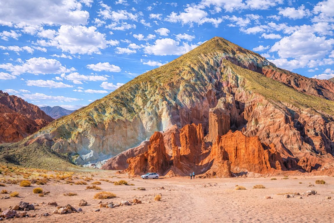
What makes Valle del Arcoíris so many colours?
The bands are mineral chemistry, not pigment or paint. Sedimentary and volcanic layers were laid down here at different times and each carries a different composition: iron oxides give the reds and rusts, copper-bearing minerals the greens, gypsum and pale clays the whites. Erosion has stripped the surface bare, so the chemistry shows.
Almost everywhere else you travel, rock colour is hidden. Soil covers it, plants grow through it, rain weathers it to a uniform grey. This corner of the Atacama has none of those. There is no soil layer worth the name, effectively no vegetation, and rainfall arrives on a scale of years rather than weeks. What you get is geology with the lid off, and at Valle del Arcoíris that means whole hillsides reading like a cut section through the region's history.
The layers themselves come from two different processes stacked on top of each other. Some are sediments, fine material washed into a basin and settled out over long periods. Others are volcanic, ash and weathered lava from the range that runs along the eastern side of this part of Chile. Each event brought its own mineral load. Later, groundwater moving through the pile oxidised some of it and altered some of it further, which is why the boundaries are sharp in places and smudged in others.
| Colour you see | Usually attributed to | What that layer generally is |
|---|---|---|
| Deep red and rust | Iron oxides in a fully oxidised state | Iron-rich sediments and weathered volcanic material |
| Ochre, yellow and orange | Iron oxides and hydroxides in other states | Fine sediments, often thinly bedded |
| Green and pale turquoise | Copper-bearing minerals and green clays | Mineralised bands, in a region famous for copper |
| White and chalk grey | Gypsum, salts and pale clays | Evaporite and ash-derived beds |
| Mauve and purple | Mixed iron and manganese-bearing clays | Transitional layers between red and grey units |
| Brown and near black | Darker volcanic ash and lava-derived debris | Volcanic units within the sequence |
The copper is not a coincidence. Northern Chile is one of the great copper provinces on the planet, and the enormous Chuquicamata mine sits not far from Calama, the airport town most visitors fly into. The same mineralising systems that made this region economically important are what tint a hillside green ninety kilometres from town. When a guide points at a green band and says copper, that is a reasonable reading rather than a tour-guide flourish.
One honest caveat. The colours are real and they are striking, but the internet has been unkind to expectations here. Heavily saturated photographs circulate that push the greens and reds well past what your eye registers. In person the palette is more muted and more layered, closer to a weathered map than a paint chart. Most people who arrive without that inflated picture in their head come away impressed. Those who arrive expecting a filtered photograph feel briefly cheated, then get over it once they walk in among the slopes.
Put The Coloured Hills And Rock Art Together
Choose what you want and the time you can give it. The result explains the trade-off before you open the booking page.
Where is Rainbow Valley, and how long is the drive?
Roughly 90 km north of San Pedro de Atacama, out in the country toward the Domeyko range and the Río Grande valley. That is a considerably longer drive than the near-town valleys, generally in the region of an hour and a half each way, on a mix of paved highway and graded desert track.
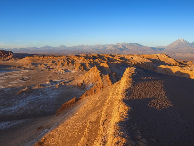
Distance is the single most useful thing to understand before you book this one. San Pedro's famous afternoon landscapes are practically suburban. Valle de la Luna is 13 km from the plaza. Valle de la Muerte is close enough to reach on a rented bicycle. Rainbow Valley is in a different category: it is a proper excursion out into empty country, and the road out is part of what you are paying for.
| Where | Approximate distance from San Pedro | Character of the journey |
|---|---|---|
| Valle de la Muerte | A few kilometres west | Minutes by road, cyclable from town |
| Valle de la Luna | About 13 km west | 20 to 30 minutes, paved then graded gravel |
| Vallecito and the Magic Bus | A short drive into the salt range | 20 to 30 minutes |
| Laguna Chaxa and the Salar | About 60 km south | Around an hour, mostly paved |
| Yerbas Buenas petroglyphs | Roughly 90 km north, near the Río Grande valley | Around an hour and a half, on the Rainbow Valley route |
| Valle del Arcoíris | Roughly 90 km north | Around an hour and a half, paved highway then desert track |
| El Tatio geyser field | About 90 km northeast | An hour and a half to two hours, climbing steeply |
Look at the last two rows together, because they explain why these tours feel so different despite covering similar distances. El Tatio is 90 km of relentless climbing to around 4,300 m, done in the dark, and it punishes anyone who has not adjusted to altitude. Rainbow Valley is 90 km of gentle desert country at a moderate elevation, done in daylight, and it punishes nobody. Same mileage, completely different day.
The route north runs out of San Pedro and into terrain that most visitors never see. Wide gravel plains, scattered scrub in the dry watercourses, the occasional herd of animals near Río Grande, and a great deal of nothing. For some people that emptiness is the highlight of the trip. For others it is ninety minutes of the same view. Know which of those you are before you book, because the driving is not incidental here.
Self-driving is possible with care and a properly checked vehicle, and the general trade-offs are set out in guided tours or self-drive. Two practical points argue for going with an operator on this particular route: the final approach is desert track rather than road, and mobile coverage disappears well before you arrive. This is not a place to discover a soft tyre on your own.
Do you need to acclimatise before visiting Rainbow Valley?
No. Valle del Arcoíris sits at a moderate elevation, a modest step above San Pedro rather than a leap into the altiplano, and the walking is easy. It is one of the few outings this far from town that makes no demand on an unacclimatised body, which is why it works early in a trip.
Altitude is the spine of planning in this region, and getting the order right matters more than getting the list right. San Pedro itself sits at about 2,400 m, which is already high enough that most arrivals feel a little breathless on stairs for the first day. From there the menu splits sharply. Some tours stay near town elevation. Others climb into country where the air holds barely half the oxygen you are used to.
| Destination | Approximate altitude | Roughly what share of sea-level air pressure | Acclimatisation needed first? |
|---|---|---|---|
| San Pedro de Atacama (town) | 2,400 m | about 75% | No, but rest on arrival day |
| Valle de la Muerte | about 2,400 to 2,600 m | about 75% | No |
| Valle de la Luna | about 2,400 to 2,600 m | about 75% | No |
| Valle del Arcoíris and Yerbas Buenas | a moderate step above town, well below the altiplanic tours | broadly similar to San Pedro | No |
| El Tatio geyser field | about 4,300 m | about 59% | Yes, ideally after two days |
| Miscanti and Miñiques lagoons | above 4,000 m | about 61% | Yes |
| Cerro Toco summit | 5,604 m | about 50% | Yes, several days |
That table is the argument for putting Rainbow Valley early. It gives you a full day out, a long drive, real landscape and an archaeological site, without taking you anywhere your lungs will complain about. Travellers who arrive from Santiago or Lima and want something substantial on day one or two, but who have been warned off the high tours, land here naturally. The full sequencing logic sits in the altitude and tour order guide.
None of that means you can be careless. The air is thin enough to dry you out fast, the sun at this latitude and elevation is fierce, and a long drive discourages people from drinking water because they are thinking about where the next toilet is. Drink anyway. Mild dehydration and mild altitude discomfort produce almost identical headaches, and only one of them is your own fault.
What are the Yerbas Buenas petroglyphs, and what do the engravings show?
They are panels of images pecked into dark volcanic boulders near the Río Grande valley, on the same route as Rainbow Valley. The engravings show llamas and other camelids, human figures, birds and foxes, and, notably, animals that do not live anywhere near here. That last detail is the interesting part.
The site is not a single carved wall. It is a scatter of large boulders across open ground, each face worked at different times and to different standards, some crowded with figures and some carrying a single animal. The technique is pecking and abrading rather than cutting: the dark weathered surface of the rock has been struck away to expose the lighter stone beneath, so the images read as pale shapes on a dark ground. That contrast is what makes them visible at all from a few metres away.
| What you are looking at | How it usually appears | Why it matters |
|---|---|---|
| Llamas and other camelids | Strings of animals in profile, sometimes roped in a line | The clearest sign of caravan traffic rather than local herding alone |
| Human figures | Simple standing forms, some with staffs or headgear | Read as drovers, hunters or figures of standing |
| Foxes, birds and local fauna | Small, often placed among the camelid groups | The animals that actually live in this landscape |
| Animals not native to the area | Forms that do not match anything living locally | The strongest evidence of long-distance contact with other ecosystems |
| Hunting and herding scenes | Figures grouped with animals in apparent action | Activity recorded, not just individual images |
| Geometric and abstract marks | Lines, circles, repeated patterns | Meaning unrecovered, and honestly presented as such |
The non-local animals are the reason archaeologists keep returning to this site. If people here engraved creatures from other ecosystems, they either travelled far enough to see them or met people who had. That fits what is known about the wider region: for a very long time the Atacama sat on caravan routes that moved goods between the Pacific coast, the high altiplano and the country beyond, with llama trains doing the carrying. Yerbas Buenas sits on natural ground for such a route, near water in a place with very little of it.
Do not expect interpretation panels of the kind you would find at a European heritage site. This is a working archaeological landscape in the open desert. A guide who knows the panels is genuinely worth having, because half the images are easy to walk past without registering them, and because the story that connects the engravings to the caravan trade is not written on anything you can read at the site itself.
The stone fortress at Pukará de Quitor is the other archaeological anchor near San Pedro, and the two work well as a pair on different days. Quitor is architecture and conflict. Yerbas Buenas is movement and contact. Between them they give a picture of the people who lived here before any of the tour vans did.
The Direct Fit And Useful Alternatives
Rainbow Valley And Yerbas Buenas
A guided outing pairing mineral-coloured hills with the Yerbas Buenas petroglyphs. Breakfast and hotel pickup are listed, with English and Spanish guiding.
Allow about six hours. Entrance tickets need arranging separately.
Book on GetYourGuideExplore Rainbow Valley And Rock Art ↗Valley Of The Moon
Make room for a desert landscape outing without committing several days. A guided Moon Valley excursion gives your afternoon a clear destination.
About four hours. Walking is involved; read the participation requirements.
Book on ViatorSee Moon Valley Departures ↗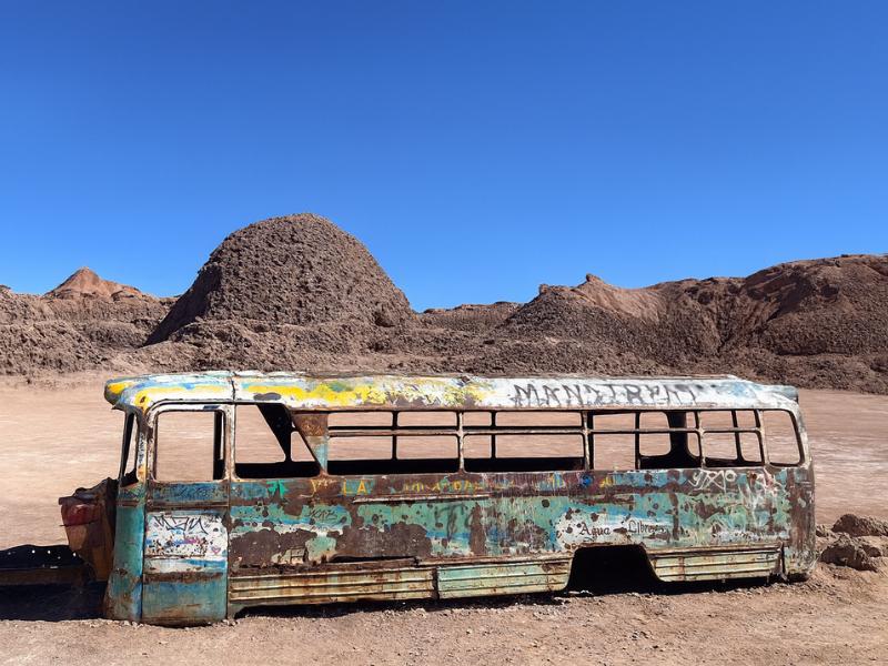
Vallecito And Magic Bus
Give your camera a different desert subject: Vallecito and the Magic Bus. The outing includes snacks, with pickup offered within the operator’s coverage.
Meeting point available outside the pickup area.
Book on ViatorSee The Magic Bus Outing ↗Why is the site protected, and what does respecting it actually mean?
Rock art is fragile in ways that are not obvious. The engraved surfaces sit on weathered stone that took thousands of years to darken, and a single touch, chalk line or footprint on the wrong rock does damage nothing can undo. Chile protects archaeological sites nationally, and local Atacameña communities manage access on the ground.
Chile's heritage framework places archaeological sites under national protection, administered through the Consejo de Monumentos Nacionales. In plain terms, removing, marking or damaging material at a site like this is not a lapse in etiquette. It is an offence. The tour we work with also includes a community entrance fee, which is how the settlement that looks after the ground is paid for the fact that visitors come.
- Do not touch the engraved surfaces. Skin oils transfer, and the contrast that makes the images visible depends on an undisturbed rock varnish.
- Never chalk, wet or outline an image to make it photograph better. It is the classic way well-meaning visitors wreck rock art permanently.
- No rubbings, casts or impressions of any kind.
- Stay on the marked route. Ground around panels can hold archaeological material that is not visible from standing height.
- Do not climb on the boulders, including ones that look blank. Faces you cannot read from below are still faces.
- Take nothing. No stone fragments, no pottery, no bone. This applies even to pieces lying loose on the surface.
- Ask before flying a drone, and accept the answer you get.
- Pack out everything, including organic waste, which does not break down in this climate the way it does at home.
There is a second layer to this that goes beyond the legal one. The people whose ancestors made these images still live in the region, and the site sits within land the Atacameña communities have a long relationship with. Treating the panels as a photo backdrop and the community fee as a nuisance misreads the arrangement badly. The same expectation applies across the reserve system administered by CONAF and the communities that co-manage it.
How does Rainbow Valley compare with Valle de la Luna and Vallecito?
Different rock, different distance, different day. Moon Valley and Vallecito are salt-range landscapes minutes from town, built around eroded shapes and a sunset. Rainbow Valley is a colour and mineralogy trip an hour and a half north, usually run in the morning, paired with archaeology rather than a pisco sour.
| Valle de la Luna | Vallecito | Valle del Arcoíris | |
|---|---|---|---|
| Distance from San Pedro | About 13 km | A short drive into the salt range | Roughly 90 km north |
| What the landscape is made of | Salt, gypsum and clay of the Cordillera de la Sal | The same salt range, quieter sectors | Layered sediments and volcanic rock, mineral-stained |
| The draw | Eroded forms, dunes, caverns, sunset | Narrow valleys, the Magic Bus, small groups | Colour bands and the Yerbas Buenas petroglyphs |
| Time of day it runs | Afternoon into sunset | Afternoon into sunset | Generally a morning outing |
| Crowds | Heaviest in the region | Noticeably lighter | Light, distance filters people out |
| Walking | 2 to 4 km in short pieces, one sand climb | Short and gentle | Short and gentle, mostly flat |
| Altitude demand | None | None | None |
| Best for | First Atacama sunset, named landmarks | Same landscape without the crowd | Geology, photography, archaeology, getting out of town |
The important thing that table shows is that these three do not compete for the same slot in your week. Moon Valley and Vallecito are variations on one theme and you would not normally do both on consecutive afternoons unless you loved the first one. Rainbow Valley is a morning, in a different direction, on different rock. It fits alongside either without repeating it.
It also solves a scheduling problem people run into on longer trips. Once the afternoons are taken by salt-range sunsets and the very early mornings by El Tatio, the middle of the day tends to go empty. A morning drive north fills that gap with something substantial instead of a second lunch in town. The wider list of options is in the things to do in San Pedro guide.
When is the best light for photographing Rainbow Valley?
Mid-morning is the practical answer, and it is the window most tours land in. Unlike the salt valleys, the colour here lives in the rock rather than in the angle of the sun, so you do not need golden hour. What you do need is light with some direction in it, which is why noon is the weakest hour.
This is the single biggest difference between shooting Rainbow Valley and shooting Moon Valley. In the salt range, the landscape is monochrome and the drama comes entirely from low sun raking across ridges. Here the drama is chemical. The reds and greens are there at any hour. The job of the light is to separate the layers by casting a little shadow into the folds, so the bands read as a three-dimensional hillside rather than a flat wall.
| Light condition | What happens to the colours | Practical note |
|---|---|---|
| Early morning, low sun | Warm cast pushes everything toward red and mutes the greens | Beautiful but chromatically dishonest, worth a few frames |
| Mid-morning | Full colour with useful shadow in the folds | The strongest window, and when most tours arrive |
| Midday, sun overhead | Colours flatten, hillsides lose their form | The weakest hour, contrast is brutal |
| High thin cloud | Saturation rises, glare drops | Quietly the best condition of all, and rare here |
| Late afternoon | Colour returns, long shadows across the slopes | Rarely available on a standard morning tour |
A few technique notes that make a real difference. A polarising filter cuts glare off dusty rock surfaces and deepens the separation between bands, and at this elevation it also darkens the sky to a degree that can look unreal, so ease it off. Shoot some frames with a person in them, because the slopes have no trees, buildings or anything else to give the scale away, and a photograph without scale reads as a close-up of a small mound.
Resist the urge to fix the colour afterwards. The temptation to push saturation until the hillsides match the version you saw online is strong, and it is exactly why other people arrive with wrong expectations. The honest version of this landscape is quite good enough.
Dust is the practical enemy. Change lenses as little as possible, keep the bag closed on the drive, and take a blower rather than a cloth for the front element. The track in kicks up fine material that gets into everything, and it is abrasive.
What does a Rainbow Valley and Yerbas Buenas outing actually involve?
An early hotel pickup, a long drive north out of San Pedro, breakfast out among the formations, time walking through the coloured hillsides, and a stop at the Yerbas Buenas petroglyph panels before the drive back. It is a low-effort, high-mileage day rather than a physical one.
| Stage | What happens | What to have ready |
|---|---|---|
| Hotel pickup | Collection around San Pedro, early, before the heat | Warm layer, the desert morning is cold |
| The drive north | Paved highway out of the basin, then desert country | Water, and something to look out of the window at |
| Breakfast stop | Eaten out in the landscape rather than in town | Included on the tour we work with |
| Rainbow Valley walking | Short, gentle walks between viewpoints on the coloured slopes | Sun protection, camera, closed shoes |
| Yerbas Buenas panels | Guided look at the engraved boulders and what they depict | Hands off the rock, questions ready |
| Return to San Pedro | The same long road back | More water than you think |
Two honest points about the shape of this day. The first is that a meaningful share of it is spent in a vehicle, and no operator can change that, because the site is where it is. The second is that the walking is genuinely easy: short distances, gentle ground, nothing technical. If you have been putting off the harder tours while you adjust to the altitude, this one asks almost nothing of you.
The listing for the tour we work with does not publish a fixed duration, and prices show differently depending on the currency your device is set to, so check both on the live listing rather than taking a figure from any article, including this one. What the listing does state clearly is what is included: breakfast, hotel pickup, a bilingual Spanish and English guide, and a community entrance fee of 10,000 Chilean pesos per person.
Choose A Date For Your Outing
Rainbow Valley And Yerbas Buenas
Select your date and party on GetYourGuide for the current price and departure options.
Explore Rainbow Valley And Rock Art ↗Which tours reach Rainbow Valley and Yerbas Buenas?
One dedicated outing covers both sites together, and one multi-day package includes a Rainbow Valley hike among its stops. Because the site is 90 km out, it is not somewhere that gets bolted onto a Moon Valley afternoon, so a purpose-built trip is the realistic way to see it.
| Tour | Listed price | Rating | Duration | What defines it |
|---|---|---|---|---|
| Rainbow Valley & Yerbas Buenas | Not published in a single currency, check the live listing | 4.7 from 40 reviews | Not stated on the listing | Both sites together, breakfast and the community fee included |
| Multi-Day Experience in San Pedro | $540 | 4.8 | 4 days | Includes a Rainbow Valley hike alongside Moon Valley, Cejar, Piedras Rojas and El Tatio |
| Valley of the Moon Tour | $35 | 4.7 | 4 hours | The classic near-town afternoon, pairs with a Rainbow Valley morning |
| Vallecito & Magic Bus Adventure | $50 | 4.9 | 4 hours | Quieter salt-range sunset, small group |
| El Tatio Geysers Experience | $62 | 4.4 | 8 hours | The high-altitude counterweight, best later in the week |
A word on the rating. The dedicated Rainbow Valley outing carries 4.7 across 40 reviews, which is a strong score on a modest sample. That reflects the site rather than the operator: fewer people go 90 km north than go 13 km west, so the review count builds slowly. Treat it as a good sign with less statistical weight behind it than the thousands of reviews on the Moon Valley formats, not as a warning.
If you are weighing a package against separate bookings, the multi-day option bundles the Rainbow Valley hike with the headline tours and takes the scheduling problem off your hands, at the cost of flexibility. The general trade-off is covered in booking in advance versus on arrival, and the budgeting picture in trip costs and budgeting.
What should you bring for a day out at Rainbow Valley?
More water than the distance suggests, serious sun protection, a warm layer for the early start, and closed shoes. There is nowhere to buy anything after you leave San Pedro, no shade at the sites, and the temperature swing between the pickup and the middle of the morning is large.
| Item | Why it matters here specifically |
|---|---|
| Two litres of water per person | Long drive, dry air, no resupply once you leave town |
| Wide-brimmed hat | No shade at either site, sun at elevation is punishing |
| High-factor sunscreen, reapplied | Thin dry air plus reflective pale ground |
| Sunglasses | Glare off light-coloured rock is constant |
| A warm layer | The pickup is cold, the middle of the morning is not |
| Closed walking shoes | Loose stone and dust, sandals fill instantly |
| Lip balm and moisturiser | Humidity here is among the lowest anywhere on earth |
| A camera and a blower brush | Fine dust gets everywhere on the track in |
| Cash in Chilean pesos | Useful in the villages, card coverage is unreliable outside town |
Two things people forget. Toilet facilities out on this route are basic where they exist at all, which is worth factoring into how much coffee you drink at the pickup. And because the drive is long, motion sickness on the graded sections catches out a few people every week. If you are prone to it, sit forward, look at the horizon and bring whatever you normally take.
The general kit list for the region is in what to pack for the Atacama, which covers the layering logic that governs almost every day here.
Who does this trip suit, and who should skip it?
It suits anyone interested in geology, photography or archaeology, anyone still adjusting to the altitude, and anyone who wants to see country beyond the standard circuit. It suits restless children and time-pressed two-day visitors far less well, mainly because of the driving.
| Traveller | Verdict | Reason |
|---|---|---|
| Photographers | Strong yes | Colour and texture unlike anything else on the circuit |
| Anyone interested in history or archaeology | Strong yes | Yerbas Buenas is the region's best rock art stop |
| Recently arrived, not yet acclimatised | Yes | A full day out with no altitude penalty |
| Older travellers | Generally yes | Gentle walking, though the drive is long on a seat |
| Families with young children | Depends on the child | Three hours of driving is the deciding factor, not the sites |
| Two-day visitors | Probably not | Moon Valley, the lagoons and El Tatio come first |
| Anyone chasing hyper-saturated photos | Manage expectations | The real palette is more muted than the internet suggests |
Our notes for the age bands sit in travelling with kids and senior travellers in the Atacama. For solo travellers, the long drive with a small group is generally an easy social day, and the wider picture is in solo female travel in San Pedro.
How does Rainbow Valley fit into a wider Atacama itinerary?
Put it on a morning in the first half of your trip, while you are still adjusting, and keep the afternoons for the salt-range sunsets. It does not compete with anything else on the circuit, which makes it one of the easiest tours to slot in without reshuffling everything around it.
| Trip length | Where Rainbow Valley goes | What it displaces |
|---|---|---|
| 2 days | Leave it out | Nothing, there is no room |
| 3 days | Morning of day two, if you skip a second salt valley | A repeat afternoon in the Cordillera de la Sal |
| 4 days | Morning of day two or three, comfortably | Nothing, it fills an empty morning |
| 5 days or more | Any morning that is not an El Tatio recovery day | Nothing |
The one scheduling rule worth respecting: do not put it the morning after El Tatio. That tour starts in the small hours and leaves most people flat by early afternoon, and stacking a three-hour round trip on top of it turns two good days into one tired one. Give yourself the gap. The worked itineraries are in the 3 to 4 day classic itinerary and five days in the Atacama, with the seasonal picture in the best time to visit.
A last thought on why this one is worth the drive. Most of what San Pedro sells is within half an hour of the plaza, and the volume of traffic on those sites is obvious from the moment you arrive. Ninety kilometres north there are coloured hills, a scatter of engraved boulders, and very few people. That combination is getting harder to find in this part of Chile, and it is the honest reason our team keeps recommending the trip to anyone with four days or more.
Make It Part Of Your Trip
The dedicated route connects Rainbow Valley with Yerbas Buenas and includes guiding and breakfast.
Rainbow Valley And Yerbas Buenas
A guided outing pairing mineral-coloured hills with the Yerbas Buenas petroglyphs. Breakfast and hotel pickup are listed, with English and Spanish guiding.
Explore Rainbow Valley And Rock Art ↗