Things to Do in San Pedro de Atacama: How to Choose
San Pedro sits at about 2,400 m with more than a dozen distinct day trips radiating out from one dusty grid of streets. The hard part is not finding things to do. It is picking a mix that does not repeat itself.
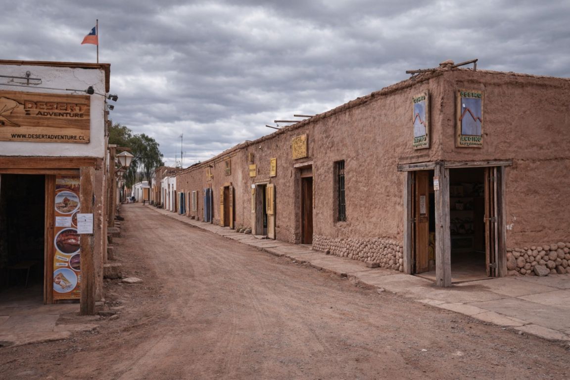
What is there actually to do in San Pedro de Atacama?
Almost everything on offer falls into seven groups: salt lagoons you float in, geothermal fields and hot springs, eroded moon-like valleys, high-altitude lagoons and salt flats, night-sky tours, active adventures, and Atacameño villages and ruins. Take one experience from at least four of those groups and no two days feel alike.
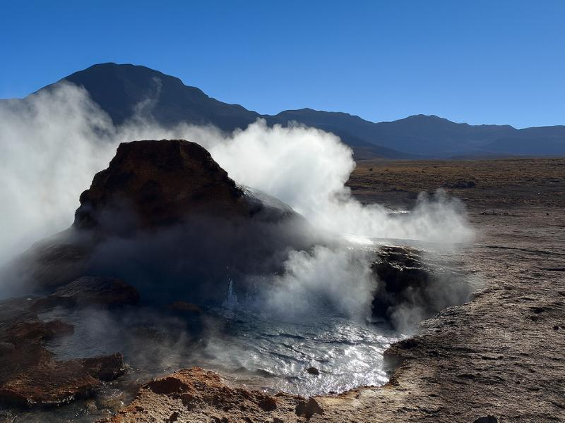
Travellers usually arrive with a list of place names scraped from other people's photographs. Baltinache, Piedras Rojas, El Tatio, Valle de la Luna. The names sound wildly different from each other, and some of them are. Others are variations on the same geology, seen at a different hour with a different guide. Book three of those in a row and by day two you are standing in front of another salt crust wondering why it feels familiar.
Grouping by experience type fixes that. It also solves the practical problem nobody mentions in the brochures: San Pedro's attractions are spread across a 4,000 m vertical range, and the order you attempt them in changes how you feel for the rest of the week. A day at 4,300 m on your first morning is a different trip from the same day on your fourth.
| Experience type | Signature places | Typical altitude | Time cost | Physical demand |
|---|---|---|---|---|
| Float-in salt lagoons | Baltinache, Laguna Cejar, Ojos del Salar, Tebenquiche | 2,300 to 2,400 m | Half day, 4 to 5 hours | Low, some walking on salt crust |
| Geothermal and hot springs | El Tatio, Termas de Puritama, Machuca | 3,500 to 4,300 m | Half to full day, 4 to 8 hours | Low effort, high cold and altitude stress |
| Eroded moon-like valleys | Valle de la Luna, Vallecito, Cordillera de la Sal, Valle Arcoiris | 2,400 to 3,000 m | Half day, usually afternoon | Low to moderate, short dune climbs |
| Altiplano lagoons and salt flat | Chaxa, Miscanti, Miñiques, Piedras Rojas | 2,300 to 4,300 m in one day | Full day, 10 to 12 hours | Low effort, long and high |
| Night sky | Observing sites outside town | 2,400 to 2,600 m | 2 to 3 hours, evening | None, but cold |
| Active and adventure | Devil's Throat, Catarpe, canyoning routes, Cerro Toco | 2,400 to 5,604 m | 2 to 7 hours | Moderate to hard |
| Villages and ruins | Pukará de Quitor, Tulor, Toconao, Socaire, Machuca | 2,400 to 4,000 m | 1 hour standalone, or folded into a full day | Low |
The rest of this guide works through those seven groups in turn, then puts them back together into mixes for trips of different lengths. If you already know how long you have, how many days to spend in Atacama covers the itinerary maths in more detail.
Choose A Mix You Will Actually Remember
Choose what you want and the time you can give it. The result explains the trade-off before you open the booking page.
Which salt lagoons can you actually float in?
Two half-day circuits let you float. The Cejar circuit combines Laguna Cejar with the Ojos del Salar sinkholes and sunset at Tebenquiche, all close to town. The Baltinache circuit runs further out to a chain of seven hidden lagoons in the Cordillera de la Sal, where one lagoon is open for swimming.
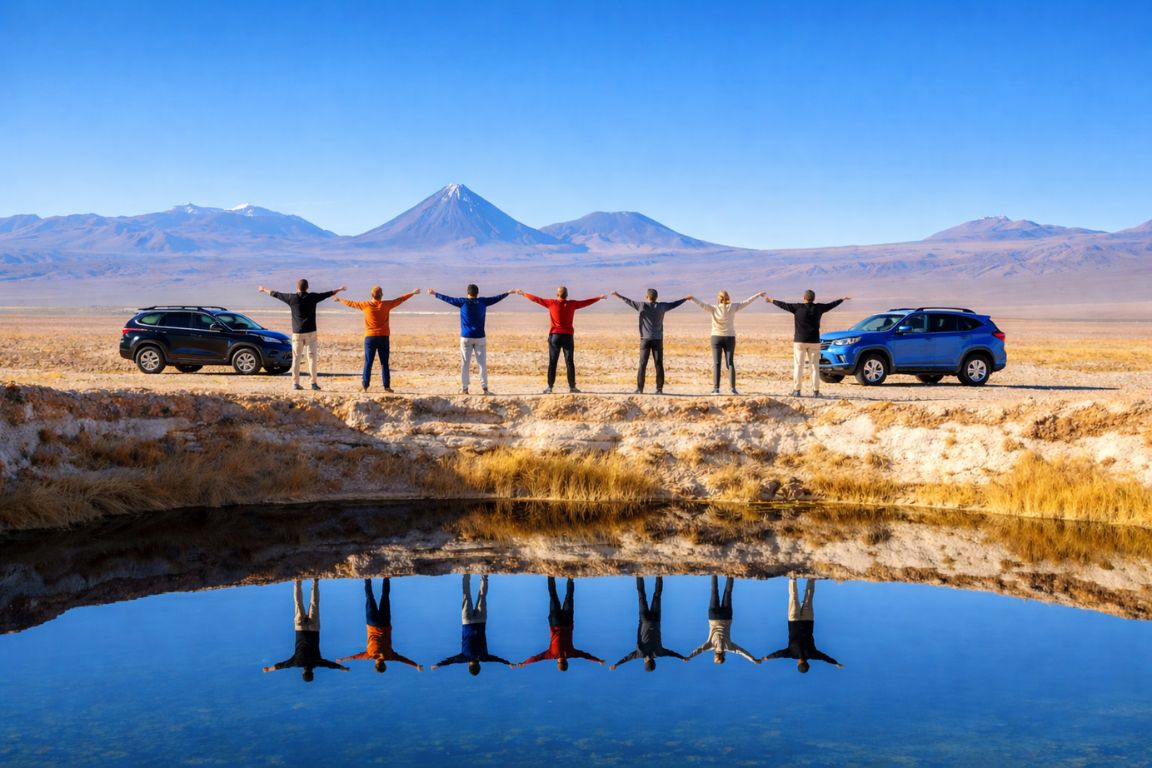
Both work on the same principle. Brine so dense with dissolved salts that your legs float up whether you want them to or not. You do not swim so much as bob, and the sensation lasts about four minutes before it stops being novel and starts being cold. What separates the two circuits is scale and setting.
Cejar is the closer option and the busier one. It is a genuine sinkhole in the salt crust, deep blue, ringed by a white shoreline, with the Licancabur cone on the horizon behind it. The Ojos del Salar are two round freshwater pools that people jump into, and Tebenquiche is a wide shallow mirror best seen with a drink in hand as the light goes. The whole thing is a five-hour afternoon.
Baltinache sits in a fold of the salt mountains on a rough gravel road, and the approach is half the appeal. Seven lagoons in a line, each a different shade of turquoise depending on depth and mineral load, with the crust crunching underfoot between them. The hidden lagoons of Baltinache half-day tour is the most-booked product in the catalogue, listed at $60 with a 4.9 rating across 6,789 bookings, which tells you something about how well the setting lands.
| Circuit | What you do | Drive from San Pedro | Crowds | Typical duration | Listed price |
|---|---|---|---|---|---|
| Baltinache hidden lagoons | Walk between seven lagoons, float in the one open for swimming, salt-mountain views | Roughly 45 minutes, mostly gravel | Moderate, capped access | 4 to 5 hours | From $60 |
| Laguna Cejar circuit | Float in Cejar, swim the Ojos del Salar, sunset drinks at Tebenquiche | Roughly 20 to 25 minutes | Higher, close to town | 5 hours | From $35 |
A practical point that catches people out: the salt dries into a white crust on your skin and stiffens swimwear. Rinse facilities at these sites are basic, sometimes a single freshwater shower, sometimes a jug. Bring more water than you think and a towel you do not care about. Rings and jewellery are best left in the hotel safe rather than lost in brine.
Doing both circuits in the same trip is defensible if you love the sensation, but it is the clearest example of the repetition trap. Most people are better served by picking one and spending the other half day on something structurally different. Our Laguna Cejar floating lagoons guide and Baltinache lagoons guide compare them stop by stop.
What are the moon-like valleys and how do they differ?
The Cordillera de la Sal west of town is a ridge of folded salt and clay eroded into dunes, amphitheatres and spires. Valle de la Luna is the ticketed, best-known section inside Los Flamencos National Reserve. Vallecito, Valle de Marte and Valle Arcoiris are smaller, quieter variations on the same rock.
This is the category people most often over-book, because every agency window on Caracoles sells a version of it. The rock is genuinely spectacular and the late light is the best of the day, but three afternoons of eroded salt formations is two afternoons too many.
Valle de la Luna is the flagship. It sits inside the reserve managed by Chile's national forestry corporation, CONAF, which controls access, opening windows and the routes you may walk. The standard evening circuit takes in the Tres Marías formations, a salt cavern section, and a climb up the Gran Duna or the Piedra del Coyote viewpoint for sunset over the Licancabur. The Valley of the Moon evening tour is listed at $35 for about four hours with park entry included, which matters because the entry is charged separately if you go alone.
Vallecito is the alternative for people who dislike crowds. Same geology, fewer vehicles, and the abandoned bus that has become an unlikely landmark. It also tends to run with a sunset drink rather than a scramble, so it suits travellers who want the light without the dune climb.
| Valley | What stands out | Altitude | Best light | Effort |
|---|---|---|---|---|
| Valle de la Luna | Tres Marías, salt caverns, Gran Duna, the classic sunset viewpoint | About 2,500 m | Last two hours of daylight | Moderate if you climb the dune |
| Vallecito and the Magic Bus | Miniature version of Moon Valley, the abandoned bus, quieter trails | About 2,450 m | Late afternoon into sunset | Low, short walks |
| Valle de la Muerte (Valle de Marte) | Steep sand ramps, sandboarding, red-brown cliffs | About 2,500 m | Morning or late afternoon | Moderate to hard on the climb back |
| Valle Arcoiris | Mineral bands in green, red and cream, well north of town | About 3,000 m | Midday, when colour saturates | Low, gentle walking |
| Garganta del Diablo | Narrow slot canyon reached by bike or on foot from Catarpe | About 2,500 m | Morning, before heat | Moderate, cycling or walking |
If you only have one afternoon for this category, take Valle de la Luna. It earned its reputation. If you have two and want variety, pair it with Valle Arcoiris rather than another salt valley, because the colour palette is completely different. The Valle de la Luna guide goes into the individual viewpoints.
Is the geothermal side worth the early start?
El Tatio is the reason people set alarms for 4 am in San Pedro. It is a geothermal basin at about 4,300 m with dozens of active geysers, and the steam columns are only dramatic in the freezing air right after dawn. Termas de Puritama is the civilised alternative, warm pools at about 3,500 m with no dawn start.
Be honest with yourself about the El Tatio trade. Pickup is typically between 4 am and 5 am, the drive climbs nearly 2,000 vertical metres in about two hours, and you arrive in the dark at temperatures that are routinely below freezing. Then the sun hits the basin and the whole field starts smoking, and most people decide it was worth it. Some do not. Altitude headaches are common on this trip precisely because you go from bed to 4,300 m with no warm-up.
The sunrise El Tatio geysers tour is listed at $62 for roughly eight hours and usually includes a breakfast on site and a stop at Machuca, a tiny high village with a whitewashed church and llamas grazing the wetland. Its 4.4 rating is the lowest of the popular tours in the catalogue, and that is not a knock on the operator. It reflects how many people underestimate the cold and the hour.
| Site | Altitude | Typical pickup | Why that timing | What to expect |
|---|---|---|---|---|
| El Tatio geyser field | About 4,300 m | 4:00 to 5:00 am | Steam columns only form in the coldest pre-dawn air | Sub-zero start, thin air, spectacular first light |
| Machuca village | About 4,000 m | On the return leg, mid-morning | Fits the descent from El Tatio | 20 to 30 minutes, church, llamas, skewers on sale |
| Termas de Puritama | About 3,500 m | Morning or early afternoon | Pools are comfortable in daylight, canyon shades early | Terraced thermal pools, listed by the operator at 28 to 31°C |
| Aguas Calientes and Tara sector | Above 4,000 m | Early morning, long day | Remote, needs the full daylight window | Rare, empty, demanding on the body |
Puritama deserves more attention than it gets. Seven or so pools stepping down a green canyon, fed by a thermal stream, reached by a boardwalk. It is the single best recovery activity in the region and works beautifully on the afternoon after El Tatio or the day after a long altiplano circuit. It is also the one activity here that people with limited mobility can usually manage. Read the El Tatio geysers guide before you commit to the alarm.
The Direct Fit And Useful Alternatives
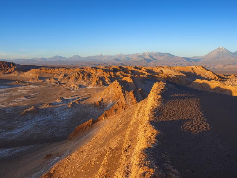
Valley Of The Moon
Make room for a desert landscape outing without committing several days. A guided Moon Valley excursion gives your afternoon a clear destination.
About four hours. Walking is involved; read the participation requirements.
Book on ViatorSee Moon Valley Departures ↗Stargazing From A San Pedro Meeting Point
Meet in town for a guided night-sky outing with telescope use, photographs, blankets and hot drinks. Choose the English stargazing option for an English-led session.
About 2.5 hours. Not for children under 4 or travelers over 80. Sky targets depend on conditions.
Book on GetYourGuideBook My Telescope Evening ↗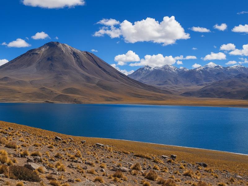
Piedras Rojas And Highland Lagoons
Give a full day to red rocks and highland lagoons without organizing the driving yourself. A connected circuit makes more sense than treating every stop as a separate trip.
A long, high-altitude outing; check participation requirements.
Book on ViatorSee The Piedras Rojas Route ↗What does the full-day southern circuit cover?
One long day heads south along the eastern edge of the Salar de Atacama and climbs into the altiplano. It typically bundles flamingos at Laguna Chaxa, the stone village of Toconao, the farming village of Socaire, the twin lagoons of Miscanti and Miñiques above 4,000 m, and the mineral shoreline at Piedras Rojas.
This is the biggest single day in the region and the one that shows the most variety per hour. It is also the one that demands the most from your body, because the vehicle climbs from roughly 2,300 m at the salt flat to well over 4,000 m in a couple of hours and stays there.
Laguna Chaxa sits inside Los Flamencos National Reserve on a crusted plain of salt that looks like broken coral. Three flamingo species feed in the shallow brine there, and the boardwalk keeps you at a respectful distance. Toconao is the white stone village 38 km south of San Pedro, usually a 30 to 45 minute stop for the bell tower and the craft stalls. Socaire is higher, terraced, and greener than anything else on the route. Then the road climbs to the lagoons.
| Stop | Altitude | Time on the ground | What it is |
|---|---|---|---|
| Toconao | About 2,475 m | 30 to 45 minutes | Atacameño village built in white liparite stone, bell tower, crafts |
| Laguna Chaxa, Salar de Atacama | About 2,300 m | 45 to 60 minutes | Flamingo feeding grounds on the salt crust inside the reserve |
| Socaire | About 3,250 m | 20 to 40 minutes, often the lunch stop | Terraced farming village, stone church |
| Lagunas Miscanti and Miñiques | About 4,100 to 4,350 m | 45 to 60 minutes | Deep blue altiplano lagoons under volcanic cones |
| Piedras Rojas, Laguna Salada sector | About 4,000 to 4,200 m | 45 to 60 minutes | Iron-red rock against white salt and turquoise water |
| Tropic of Capricorn marker | About 2,400 m | 10 minutes | Roadside photo stop on the return |
Expect 10 to 12 hours door to door and a 7 am to 8 am pickup. Operators differ on whether Piedras Rojas is included, because access there has been restricted at times by the community that manages it, so read the itinerary rather than the title. Our Piedras Rojas guide and Toconao village guide cover the individual stops.
What are the night-sky options, and do you need a tour?
The Atacama is one of the driest, clearest and least light-polluted places on Earth that ordinary travellers can reach, so the sky is worth a dedicated night. Commercial tours drive you clear of San Pedro's streetlights, set up optical telescopes, and guide you around the southern sky. You can also simply walk out of town and look up.
The paid version buys you three things you cannot get alone: telescope time on planets and deep-sky objects, someone who can name what you are seeing in the southern hemisphere sky, and usually an astrophotography portrait under the Milky Way. Tours run in a two to three hour window and are suspended or reshaped around the full moon, when the sky is too bright for faint objects.
| Night-sky option | Duration | What you get | Listed price |
|---|---|---|---|
| Premium roofless stargazing experience | 3 hours | Large-aperture telescopes, expert astronomer, personal Milky Way photo, hot drinks | From $65 |
| Intimate roofless stargazing adventure | 2 hours | Telescope and naked-eye viewing, sky storytelling, astrophotography souvenir | From $45 |
| Small-group astronomical adventure | 2 hours | Remote observing site, guided constellation tour, photo souvenir | From $35 |
| Walking out of town yourself | As long as you like | Naked-eye Milky Way, no telescope, no guide | Free |
One point of confusion is worth clearing up here. ALMA, the giant antenna array on the Chajnantor plateau, is not a stargazing venue. It is a radio observatory, its public visits are daytime tours of the support facility, and you never look through anything. The ALMA versus a stargazing tour comparison explains why people book the wrong thing, and the broader astronomy in the Atacama guide covers what is visible by season.
What active and adventure options exist?
Beyond the sightseeing circuits there is a genuine adventure layer: mountain biking to Devil's Throat canyon, horseback riding through the salt mountains, canyoning with rappels down desert waterfalls, a guided climb of Cerro Toco at 5,604 m, and a sunrise balloon flight over the valleys.
These are the activities that make a repeat visit interesting, and the ones most first-timers never look at because the classic circuits fill the schedule. They also spread across a wide fitness range, from a two-hour horseback ride suitable for beginners to a high-altitude summit push.
| Activity | Duration | Maximum altitude | Fitness needed | Listed price |
|---|---|---|---|---|
| Horseback ride to Dinosaur Valley and Catarpe | 2 hours | About 2,500 m | Beginner friendly, horse matched to level | From $68 |
| Mountain bike to Devil's Throat via Quitor | 4 hours | About 2,600 m | Moderate, comfortable on a bike | From $85 |
| Canyoning with four rappels | 6 hours | High-altitude approach hike | Moderate to good, no vertigo | From $189 |
| Cerro Toco summit climb | 7 hours | 5,604 m | Good, plus real acclimatisation | From $150 |
| Sunrise hot-air balloon flight | 3 hours | Airborne over the valleys | None, standing only | From $350 |
The Cerro Toco climb to 5,604 m is the one to think hardest about. It is not technical, and the trailhead is high enough that the walk itself is short. What it demands is days of prior acclimatisation. Attempting it in your first 48 hours in San Pedro is how people end up turning back at 5,200 m with a headache and a wasted day. Plan it for late in a trip, after the altiplano circuit has already taken you above 4,000 m.
Where do the villages and ruins fit in?
The Atacameño, or Lickanantay, culture is still present in the oases along the salt flat. Pukará de Quitor is a pre-Hispanic hillside fortress three kilometres from town. Aldea de Tulor is an excavated circular settlement in the sand. Toconao, Socaire and Machuca are living villages you pass through on tour days.
This category rewards the traveller who slows down. The desert scenery is what sells San Pedro, but the human story of how people farmed, herded and defended these oases for millennia is the part that gives the landscape meaning. It is also the cheapest category on this list, because two of the best sites are within cycling distance of your hotel.
| Site | Distance from town | Altitude | How to reach it | Time needed |
|---|---|---|---|---|
| Pukará de Quitor | About 3 km north | About 2,500 m | Walk, bike, taxi, or on a bike tour | 1.5 to 2 hours |
| Aldea de Tulor | About 9 km southwest | About 2,400 m | Bike or taxi, hot and exposed ride | 2 to 3 hours including travel |
| Toconao | About 38 km south | About 2,475 m | Stop on the southern full-day circuit | 30 to 45 minutes on tour |
| Socaire | About 90 km south | About 3,250 m | Stop on the same circuit | 20 to 40 minutes on tour |
| Machuca | North, on the El Tatio road | About 4,000 m | Return leg of the geyser tour | 20 to 30 minutes |
Quitor is the standout, and the reason is the view rather than the walls. From the upper terraces you look straight down the green ribbon of the San Pedro river against a sea of dust and rock, and the logic of the whole oasis becomes obvious in one glance. The site is managed by the local community and charges an entry fee. The Pukará de Quitor guide has the practical detail.
Choose A Date For Your Outing
Valley Of The Moon
Select your date and party on Viator for the current price and departure options.
See Moon Valley Departures ↗What can you do in town, on foot, for free?
San Pedro's centre is walkable in twenty minutes end to end. Free or near-free: the adobe church on the plaza, Caracoles street and its craft market, the ayllu lanes and irrigation channels just outside the grid, and the sunset walk toward the Cordillera de la Sal from the edge of town.
Set expectations properly. The desert around San Pedro costs money to reach, and most of the free layer is the town itself rather than the landscape. That said, an evening on foot here is genuinely pleasant, and after a 4 am geyser start it may be all you want.
The Iglesia San Pedro on the plaza is the anchor. Whitewashed adobe, a roof structure of cactus wood lashed with leather, and a cool dark interior that drops ten degrees the moment you step in. Caracoles is the commercial spine: agencies, empanada windows, alpaca knitwear, and a stream of dusty 4x4s. It is touristy, unapologetically, and still the best place in town to feel the rhythm of the place at dusk.
| On-foot option | From the plaza | Cost | Best moment |
|---|---|---|---|
| Iglesia San Pedro and the Plaza de Armas | 0 minutes | Free | Late afternoon shade |
| Caracoles street and craft market | 1 minute | Free to browse | Early evening |
| Ayllu lanes toward Solcor and Coyo | 15 to 25 minutes | Free | Golden hour, dust in the light |
| River path toward Quitor | 30 to 40 minutes | Free until the site entrance | Morning, before heat |
| Pukará de Quitor site itself | 40 minutes walk | Community entrance fee, budget a small amount | Late afternoon for the valley view |
| Stargazing from the edge of town | 15 minutes | Free | Any moonless night |
Two honest cautions. Walking out to Tulor in the middle of the day is a bad idea without a bike and a lot of water, because there is no shade at all. And the free stargazing is spectacular but it is naked-eye only, which is a different experience from a telescope night, not a substitute for one. If cost is the driver, budget-friendly activities in the Atacama breaks down what a lean trip really looks like.
How should altitude shape the order you do things in?
Build the week upward. Spend your first day at town altitude, around 2,400 m. Add a valley or lagoon afternoon on day two, still below 2,600 m. Save the altiplano circuit above 4,000 m and El Tatio at 4,300 m for day three or later, and put any summit attempt at the very end.
Almost every bad Atacama story starts the same way: landed in Calama at midday, transferred to San Pedro, went straight onto a 4 am geyser tour the next morning. That climbs from sea level to 4,300 m in under 48 hours, and the body has no chance to adjust. Headache, nausea and a ruined day are the usual result.
| Day | Suggested altitude ceiling | Example activity | Why |
|---|---|---|---|
| Arrival day | 2,400 m | Town on foot, early night, plenty of water | Lets the body register the change |
| Day 2 | 2,600 m | Valle de la Luna or a salt lagoon float | Full day out with no altitude load |
| Day 3 | 3,500 m | Termas de Puritama, or an evening stargazing tour | Gentle first climb |
| Day 4 | 4,300 m | Southern altiplano circuit or El Tatio | Body has had three nights at 2,400 m |
| Day 5 or later | 5,604 m | Cerro Toco summit | Only sensible after repeated high days |
If your trip is shorter than that, compress the middle rather than the start. Doing the altiplano on day two is survivable for most fit travellers. Doing it on the morning after you fly in is what causes trouble. Our altitude acclimatisation and tour order guide sets out the sequencing in full.
How do you build a mix that does not repeat itself?
The rule is one experience per category, in rising altitude order. Two full days, two half days and one night is the shape of a strong four-day trip: one valley, one float, one altiplano circuit, one geothermal morning, one stargazing night. Add adventure or villages only once those five are placed.
Below are the mixes we would actually recommend. They are deliberately not maximal. Leaving one afternoon unbooked in San Pedro is not laziness, it is what keeps day four enjoyable after two dawn starts.
| Trip length | Recommended mix | What you leave out |
|---|---|---|
| 2 days | Valle de la Luna sunset, one salt lagoon float, one stargazing night | El Tatio, the altiplano circuit, everything above 3,000 m |
| 3 days | Add the southern altiplano circuit on the last full day | El Tatio, adventure activities |
| 4 days | Add El Tatio at sunrise, plus a free afternoon for the town and Quitor | Cerro Toco, canyoning, balloon |
| 5 days | Add Puritama as a recovery half day and one adventure activity | Remote Tara sector, multi-day extensions |
| 6 days or more | Add Cerro Toco or canyoning, Tulor and Toconao at your own pace | Very little |
Travellers who want the sequencing solved for them often take a bundle instead. The three-day and four-day combos in the catalogue place El Tatio, the altiplano circuit, a valley sunset and a float in a fixed order, which removes the guesswork about altitude and pickup times. That comes at the cost of flexibility, so it suits planners less than it suits people who want to stop planning.
What should you book ahead, and what can wait?
Book the night-sky tours, El Tatio and any full-day altiplano circuit before you arrive, particularly between December and February and around Chilean holidays. Valley sunsets and lagoon half-days can usually be arranged a day or two ahead from town, though the good small-group operators still sell out.
The constraint is vehicle seats, not the sites themselves. Stargazing tours cap group sizes because there are only so many telescope eyepieces, and they cancel around the full moon, which compresses demand into the darker half of every month. Full-day circuits leave once daily and fill early.
| Experience | How far ahead | Why |
|---|---|---|
| Stargazing tours | Before arrival, ideally weeks | Small groups, moon-phase cancellations, high demand |
| El Tatio sunrise | Before arrival or 2 to 3 days ahead | Single daily departure, early pickup logistics |
| Southern altiplano full day | Before arrival or 2 to 3 days ahead | Long day, one departure, popular |
| Balloon flight and canyoning | Weeks ahead | Very small capacity, weather dependent |
| Valley sunsets and lagoon floats | 1 to 2 days ahead | Multiple departures daily |
| Town walking, Quitor, Tulor | No booking | Self-guided |
Two further variables sit outside your control. Seasonal weather closes the El Tatio road occasionally in the January and February altiplano rains, and community-managed sites can restrict access at short notice. Both are covered in the best time to visit guide, and booking tours in advance versus on arrival weighs the trade-off in detail. If you are still deciding whether the trip earns the journey at all, our honest take on whether the Atacama is worth visiting is the place to start.
Make It Part Of Your Trip
Start with a Moon Valley afternoon, then choose a different experience for another day.
Valley Of The Moon
Make room for a desert landscape outing without committing several days. A guided Moon Valley excursion gives your afternoon a clear destination.
See Moon Valley Departures ↗